


The Isle of Wight’s Estuaries
Estuaries are amongst the most diverse and interesting places in the UK and the Island’s estuaries are no exception. There are five estuaries located on the north and north-eastern coasts of the Island. Each has unique characteristics and is subject to a combination of different pressures, either natural or as a result of human activity. The Island’s estuaries have been internationally recognised as important for nature conservation and are included in the Solent European Marine Site.
Bembridge harbour
Bembridge harbour
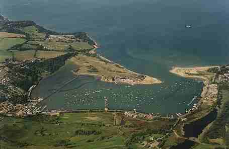 D. French | The Eastern Yar flows into Bembridge harbour on the north-easterly coast of the Island. The harbour’s seaward boundary is maintained by the presence of two mature sand spits, St Helen’s Duver and Bembridge Point. |
Historically the harbour has undergone a series of land claims and in 1874-79 an area of tidal silt was claimed to form Brading Marshes. Bembridge harbour today has a wide variety of estuarine habitats including mudflats, sandflats, lagoons and shingle spits. The combination of these habitats makes the area particularly valuable for many plants and animals. The harbour itself is currently managed by the Bembridge Harbour Improvements Company.
Medina Estuary
Medina Estuary
| The Medina is the longest estuary on the Isle of Wight and extends nearly7km between Cowes and Newport. It is an important waterway for industry, transport and recreation and supports an impressive variety of plants and animals, some of which are nationally rare. | 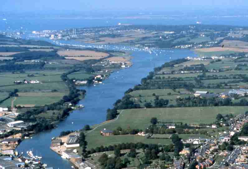 D French |
The estuary lies in a wide shallow valley and sediment build up has resulted in its characteristic mudflats. The Medina has local, national and European designations to conserve its value for nature. These aim to protect the estuary from damaging operations and activities and allow the estuary to develop naturally.
Click here for more information about the Medina Estuary
Newtown Estuary
Newtown Estuary is located on the northern coast of the Isle of Wight between the Medina and the Western Yar and forms an integral part of the Solent’s estuarine system. It is a National Nature Reserve and supports nationally important and threatened wildlife. The estuary is a particularly significant feeding and over-wintering ground for waders and other wildfowl.
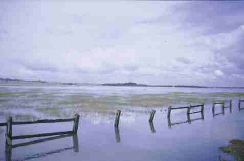 T. Slade | The landscape of the Newtown River has changed little over the centuries and it is an area rich in features of historical interest. Newtown, also known as Francheville, was established as a ‘Free Town’ by the Bishop of Winchester in 1256. The site was chosen because of its deep and sheltered harbour, saltworks and shellfish beds. |
The town flourished for many years until the combination of a French raid on the town in 1377 and the gradual silting up of the harbour led to a loss of trade. Newtown was soon replaced as the Island’s main port by the larger ports at Yarmouth and Newport and the population gradually diminished.
The estuary came under the protection of the National Trust in 1965. Local yachtsmen and naturalists raised funds for its purchase following a proposal to develop a nuclear power station at Hamstead. It remains a beautiful, tranquil and unspoilt area of the Island.
For more information about Newtown Estuary, the harbour and the work of the National Trust please contact: The National Trust at Longstone Farmhouse, Strawberry Lane, Mottistone, Isle of Wight PO30 4EA Tel: 01983 741020.
The Western Yar
| The Western Yar flows through the Isle of Wight’s Area of Outstanding Natural Beauty (AONB) from Afton Marsh Local Nature Reserve to the Solent at Yarmouth. The estuary maintains a range of important habitats, including saltmarsh, reedbeds, and sand dunes, and these in turn host a rich abundance of wildlife. | 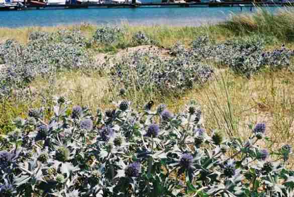 |
Most of the estuary has been designated as a Site of Special Scientific Interest (SSSI) and more recently, its nature conservation value has been recognised through European designations.
The estuary and harbour also support a wide range of important commercial interests and recreational activities. Yarmouth harbour is home to one of the Islands three car ferry links to the mainland and is a popular destination for visiting yachtsmen. The harbour also provides moorings for commercial and local recreational vessels.
Click here for more information about the Western Yar
Wootton Creek
Historically also called Fishbourne Creek and Wootton Haven, Wootton Creek is a small drowned estuary extending some 1750 metres inland from the Solent. Positioned on the north coast, the estuary is sheltered from the prevailing south westerly winds and shingle banks flank its entrance to the sea.
The upper estuary is modified by the creation of an impounded tidal mill pond which powered a tide mill on the western bank from the 11th Century. The upper estuary/mill pond extends further inland amongst mixed woodland of the Island’s Area of Outstanding Natural Beauty (AONB) and supports a heronry.
| The village of Wootton Bridge grew up around the mill and the pub and was previously in the parish of Arreton, providing the parish’s outlet to the sea. The tide mill was demolished in the mid 1960s but the main Ryde to Newport/East Cowes crosses the embankment with a bridge over the sluice gate control. | 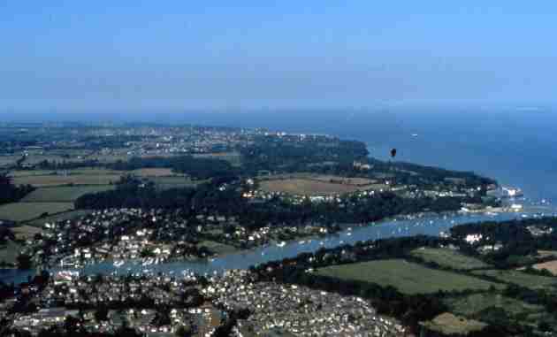 D French |
The banks of the estuary are largely in residential use with three small boatyard/employment sites and other boat sheds. There are drying fore and aft moorings for locals along both sides on the intertidal mud with some private pontoons and a public slipway by the bridge.
One of the Island’s 3 car ferry terminals is located on the eastern side of the mouth of the creek at Fishbourne, (originally called Fishhouse). Ferries ply the deepened channel from here across Spithead to Portsmouth.
One of the Island’s 3 car ferry terminals is located on the eastern side of the mouth of the creek at Fishbourne, (originally called Fishhouse). Ferries ply the deepened channel from here across Spithead to Portsmouth.
Page last updated on: 10/10/2001