PAPER B2
ISLE OF WIGHT COUNCIL DEVELOPMENT CONTROL COMMITTEE –
MONDAY 18 FEBRUARY 2002
REPORT OF THE STRATEGIC DIRECTOR OF CORPORATE AND
ENVIRONMENT SERVICES
|
|
TCP/14875/F
P/01437/98 Parish/Name: Ventnor Registration Date:
16/10/1998 - Full Planning Permission Officer:
Mr. C. Boulter
Tel: (01983) 823568 2 no. rock armour breakwaters to
form a fairweather haven for vessels, new slipway (Revised Plans and
Environmental Statement) (readvertised application) foreshore, east of Southern Water
Pumping Station, Esplanade, Ventnor, PO38 |
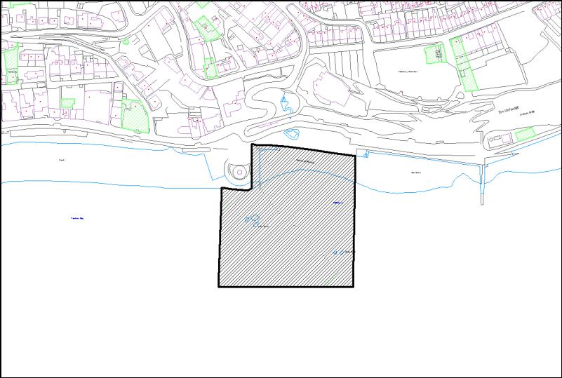
Site and Location
Site for proposed development is foreshore/sea bed to
the south and east of the Southern Water pumping station on Ventnor sea front,
at the foot of the Cascades.
Relevant History
Application submitted April 1973 for construction of boat harbour on foreshore on east side of Ventnor pier extending for 240 metres to Collins Point breakwater. That application withdrawn June 1973. The application in 1989 for harbour wall extending some 300 metres from shore and enclosing 320 marina and visitors' berths, with reclamation of land for waterside village, leisure uses, starter homes, fish quay, ferry terminal, boatyard and commercial area. This application considered acceptable in principle by former Borough Council working party, subject to geology, hydrology, commuted car parking payment, full remote sensing of sea bed to identify marine archeological features and more details of visual impact of sea walls and associated development. Eventually withdrawn in 1990 in favour of an alternative proposal submitted in May of that year seeking outline consent for sea wall, 300 berths in inner and outer harbours, 330 dwellings, car parks, chandlery, harbour offices and access road, again on foreshore and reclaimed land between Ventnor Pier and Wheelers Bay. That application was refused by the former Borough Council in August 1990 as contrary to policy, visual intrusion, excessive traffic generation in area of difficult access, inadequate information regarding ground stability, tidal flows etc.
Further application submitted January 1991 in outline
for construction of sea wall for 530 berth harbour, 405 dwellings, 100 holiday
units, retail, bowling greens, ten-pin bowling, squash courts, sports hall,
parking and offices. Former Borough
Council determined proposal required environmental impact assessment but none
was submitted and the application was treated as withdrawn in February 1993.
December 1992, former County Council considered application
for transfer sewage pumping station on site of current pumping station,
required in connection with proposed long sea outfall at Flowers Brook. That scheme was capable of extension through
Harbour Revision Order to create a fishing jetty and small harbour. No objection raised by former Borough
Council and former County Council agreed principle, subject to a Legal
Agreement regarding control of construction traffic, delivery of material. Agreement not signed and application
withdrawn in 1992.
Approval granted in September 1996 for erection of
building to contain waste water pumping station and associated apparatus with
public viewing deck, subject to a number of conditions. This was in connection with a revised sewage
disposal scheme involving the pumping of waste water for treatment at
Sandown. That consent has now been
implemented and the pumping station and waste transfer are operative. At the time of that approval, the Planning
Authority was advised that a Harbour Revision Order, allowing harbour
development to take place at the site was obtained by the former Borough
Council and remains valid and that a further jetty extension could be
constructed from the pumping station to allow formation of a harbour as
originally envisaged.
The "rock armour" revetment for coastal
protection work between Swayle Groyne and Collins Point to the east of the
application site was approved in August 1994.
Details of Application
Construction of two breakwaters, one extending south
for some 60 metres southwards from the south eastern part of the pumping
station before turning through almost 90 degrees to extend a further 90 metres
slightly south of east. A second
breakwater would be constructed some 70 metres east of the pumping station and
immediately west of the rock armour defence scheme for Eastern Esplanade, and
projecting some 65 metres to the south.
This would enclose an area of some 60 metres by 80 metres with a narrow
(20 metre wide) shipping entrance at the south eastern corner. Within the enclosed area, a new slipway, at
right angles to Eastern Esplanade and immediately opposite "Island
Pool" would project some 45 metres into the harbour area. Locations of possible pontoons and trot
moorings could be accommodated within the harbour area which would also contain
rock armour in its north western corner, a new shingle beach between the
proposed slipway and the eastern breakwater.
A plan and proposed cross sections of the proposal are
attached as Appendix A.
The harbour would be functional for approximately half
of the tidal cycle (i.e. some three hours either side of high tide) and only
during relatively calm weather conditions.
Much of the area within the Haven will dry out during low water Spring
tides and access will be limited to vessels with a draught less than 2
metres. Boats expected to use the Haven
include flat bottomed fishing vessels, tender boats to larger vessels and small
bilge keel sailing cruisers.
Eight off-shore moorings are proposed, running
eastwards from a point some 120 metres south of the end of the western
breakwater.
The eastern breakwater would have a width at beach
level of approximately 17 metres and be constructed from rock boulders of
appropriate size, similar to those protecting the Eastern Esplanade and the
pumping station. The sides of the
breakwater would slope to give a level platform 5.7 metres wide at a height of
5.5 metres above Ordnance Datum (about 6.24 metres above mean low water neaps).
The western breakwater would be constructed in a
similar fashion but would have a maximum width of some 8 metres at its top,
with a concrete pedestrian walkway, protected to the west and south by a 0.6
metre high concrete face and to the north and east by similar height stainless
steel handrail.
Extracts from the plans and cross sections submitted
are attached as Appendices A and B.
Development Plan Zoning and/or Policy
Site is outside development envelope defined in
Unitary Development Plan (UDP) as it is seaward of mean high water however, the
proposal involves development attached to the land extending above mean high
water and therefore planning consent is required. It is also within a candidate Special Area of Conservation (cSAC)
defined under the Conservation (Natural Habitats etc.) Regulations 1994. The Town and Country Planning (Environmental
Impact Assessment) (England and Wales) Regulations 1999 set out in Schedule 2
those types of development where Environmental Impact Assessment (EIA) is
required. As part of the development
now proposed is to be carried out in a sensitive area (the cSAC) the proposal
is considered to be "schedule 2 development" and an EIA will be
required.
Relevant national policy guidance is as follows:
PPG1 - Establishes principles of determination of
applications and acknowledges the importance of the "plan led system"
and the principle contained within Section 54A that an application for planning
permission shall be determined in accordance with the Development Plan, unless
material considerations indicate otherwise.
PPG9 - Nature Conservation. Annex C sets out the processes regarding determination of
applications for development in a cSAC.
The determining Authority must decide whether the proposal has significant
effect, individually or in combination, on those conservation objectives for
which the site was designated. The
advice of English Nature may be needed and if necessary an "Appropriate
Assessment" under the Habitats Regulations must be prepared by a competent
Authority and taken into account when any decision on the application is made.
PPG14 - Development on Unstable Land. This confirms that responsibility and
subsequent liability for safe development rests with the developer and/or the
landowner. It is not the responsibility
of the Local Authority to investigate the ground conditions of any particular
development site, "unless they propose to develop it".
PPG20 - Coastal Planning. This confirms that the coast is an important national resource,
defines the coastal zone both seaward and landward of the coastline relative to
the natural processes and human activities involved. Four broad types of coast are defined:
The undeveloped
coast, conserved for both its landscape value and nature conservation interest;
Other areas of
undeveloped or partly developed coast;
The developed coast,
usually urbanised but also containing other major developments;
The despoiled coast,
damaged by dereliction, e.g. former industrial uses.
Against this background, key policy issues for coastal
planning are:
Conservation of the
natural environment;
Development,
particularly that which requires a coastal location;
Risks, including
flooding, erosion and land stability;
Improving the
environment, particularly of urbanised or despoiled coastlines.
Many coastal development proposals will have significant
effects on natural environment and visual impact and will be subject to
environmental assessment under the Environmental Impact Assessment (England and
Wales) Regulations 1999.
Mention is made of the growth in demand for marinas
and other facilities for boat mooring, parking and launching and indicates that
policies for development of further facilities should be based on an assessment
of the capacity of the local environment to accommodate further water-based
recreation. Any associated developments
such as access and parking should be assessed separately on its own merits,
taking into account whether a coastal location is needed. It is recognised that tourism is growing and
may require coastal locations and supporting infra-structure. Such development should normally be guided
to existing urban areas particularly where they can contribute to the
regeneration of seaside resorts and waterfront areas.
PPG21 - Tourism.
This points out that popularity of many seaside resorts has declined in
recent years but seaside tourism remains the largest single component of the
domestic holiday market. Plans should
aim to resolve potential conflicts between other uses and a town's success as a
tourist resort and there should be particular emphasis on sympathetic design
and seafront enhancement.
Local policy considerations are as follows:
The UDP (adopted May 2001) is the development plan for
the area and shows that most of the proposed development (i.e. that part below
mean low water) is outside the defined development envelope. The remaining part (i.e. that part of the
beach and foreshore above mean low water) is within the development envelope
but unallocated in the plan. The
Ventnor Conservation Area is nearby to the north, and includes the Cascades Garden,
the Cascades Highway and the Chalet Hotel.
A narrow strip of land between the Winter Gardens and the Eastern
Esplanade forms the western extremity of the Ventnor Eastern Cliffs SINC which
is designated because of its importance as a coastal habitat.
Relevant strategic policies of the UDP are S1 (New
Development Concentrated Within Existing Urban Areas), S5 (Proposals for
development which on balance enhance the Island's economic, social or
environmental position will be approved, provided any adverse impacts can be
ameliorated), S6 (All development expected to be of a high standard of design)
and S10 (Development in areas of designated scientific or natural conservation
value will be permitted only if it will conserve or enhance the features of special
character of these areas).
Other relevant specific policies relate to Design and
Standards (D1, D11, D14), Building Conservation and the Historic Environment
(B6), Employment (E8), Tourism (T2, T8), Countryside and Coast (C1, C5, C9),
Transport (TR7, TR8) and Leisure and Sport (L8).
Representations
Ventnor Town Council sees no reason why consent
should not be issued. Subsequent letter
to Hampshire and Isle of Wight Wildlife Trust explaining Town Council's view of
the importance of the scheme to the economy of Ventnor and inviting the Trust
to attend a meeting to explain their objections to the scheme.
Highways Engineer recommends conditions if approved.
Chief Environmental Protection Officer has examined
the scheme and points out that there
are no classified shell-fish beds in the area, current noise levels referred to
in the Environmental Statement are not reliable because of variations in sea
and weather conditions, construction noise will be inevitable and conditions
controlling all operations will be necessary.
He agrees that the operation of the completed Haven is unlikely to lead
to significant noise problems.
Environment Agency has no objection in principle but
comments that proposal may affect South Wight candidate Special Area of Conservation
(cSAC) and Authority should liaise fully with English Nature on this
issue. The Agency has been sent a copy
of the Environmental Statement, but comments on it are still awaited.
English Nature, on initial submission of scheme,
requested Formal Environmental Assessment and Appropriate Assessment of
project. Unless it could be shown that
there would be no significant effect on the cSAC, would be obliged to
object. Following detailed discussions
between English Nature, Environment Agency, Southern Water, DETR and the
Isle of Wight Council and its agents, English Nature advised in January 2000
that the proposed development is likely to have significant effect on the South
Wight Maritime cSAC and Appropriate Assessment and Environmental Assessment are
therefore required. English Nature
subsequently closely involved in preparation of an Environmental Assessment
which has been used to inform the Appropriate Assessment carried out by DEFRA
as competent Authority.
English Nature have confirmed that their comments have
been incorporated into the Environmental Assessment carried out on behalf of
the Council. The draft Appropriate
Assessment carried out by DEFRA has been received and is referred to in the
Evaluation section of this report.
The Hampshire and Isle of Wight Wildlife Trust has
submitted two letters, the first expressing concern that the proposal is a
departure from the local plan and needs Appropriate Assessment not only of
direct impact but of coastal processes and additional facilities, such as
moorings. The development is likely to
affect the cSAC and therefore objection is raised.
Second letter from the Trust, following receipt of the
Environmental Assessment confirms their objection and also objected to DEFRA
under the Coastal Protection Act.
The Trust believes the proposal will have a damaging impact on nature
conservation interests, recognised of being of International Importance to
Wildlife. The works of mitigation
proposed appear inappropriate in the absence of any Environmental Impact
Assessment and Appropriate Assessment under the Habitats Regulations. The proposal is one of a series of projects
which has seen the gradual loss or planned loss of coastal habitats on the
south coast of the Island. Objection is
made to the likely harm the proposal will have in its own right and in
combination with other plans and projects.
There appears to be no coast defence justification for the works and if
the long established coast defence scheme is no longer adequate, the first
option should be to repair those works rather than construct a major new
development into the foreshore.
Development will entail damage and loss of some 0.31
hectares of South Wight maritime cSAC and runs contrary to Island's own Nature
Conservation policies in the UDP and to National policies expressed in
PPG9. Proposal is a significant
departure from the UDP. Site includes
areas of sub-tidal reef with notable assemblages of marine flora and fauna
recognised as of International Importance.
Applicants Environmental report concludes will be an adverse impact on
site and proposal should be made subject to an Appropriate Assessment. As Isle of Wight Council are both applicant
and determining Authority, in preparing Appropriate Assessment competent
Authority should seek advice of the public.
President of the Isle of Wight Natural History and
Archaeological Society comments that Collins Groyne at eastern end of site
should not be removed as it has high environmental value. Although deteriorating it provides a habitat
for numerous small crustaceans and other marine life and the bird species which
feed on them. A list of ten birds
observed feeding and seven birds roosting on the Groyne is submitted and it is
suggested that it should be left in-situ and untouched.
Ventnor Yacht Club offers wholehearted support for the
proposal which would bring major benefits for tourism and the town.
One local resident objects on grounds of adverse
effect on livelihood as a commercial lobster fisherman, both during and after
construction. Proposal affects one
third of his lobster grounds and rock shipment by sea will affect grounds to
east and west so approximately half income will be lost. Business only just recovering since Wheelers
Bay scheme completed. Rocks left over
from that scheme should have been used in that location and not transported to
the southern water site.
One local resident supports proposal as without this,
tourist, sailing and natural improvement no future development or investment in
the town can be seen. Visitors would be
encouraged and marine life will colonise the rock armour when it is in place.
Evaluation
Eight major issues need to be considered in the
determination of this application.
These are the visual impact on the coastline, the economic impact on the
town and the area, impact on highways capacity and safety from any increase in
traffic, the impact on the area during construction, effect on ground stability
in the area, effect on noise and air quality both during and after
construction, effect on coastal processes and finally, effect on the ecology of
the area, particularly bearing in mind its status as a cSAC.
Visual Impact
The site in question is a focal point of Ventnor
Esplanade and seafront, separating the more developed frontage to the west from
the undeveloped cliffs rising above the eastern esplanade. The Southern Water pumping station presently
makes a significant contribution to the character of the area, serving a
similar visual function to the former pier which stood near this point. The proposal to extend the rock armour which
supports the pumping station at sea level by some 60 metres out to sea is
thought to add emphasis at this point and make a positive contribution to the
landscape, rather than negative. The
use of the harbour as a focus for boats, landing of fish and marine activity is
also thought to add visual interest and create a focus for both locals and
visitors alike. The extension of the
pumping station walkway along the top of the western breakwater will also to a
small degree replicate the previous function of the pier in this location. The materials used i.e. the rock armour for
both eastern and western breakwaters, together with the small amount of
concrete finish to the top of the western breakwater will reflect the materials
used in the construction of the pumping station and the coastal defences to the
east of Collins Groyne. I therefore
suggest that the visual impact of the proposal will be acceptable and, when in
use, will be a positive feature on the sea front.
Economic Impact
The Environmental Impact Assessment submitted in
connection with the application indicates benefits from the scheme accruing
through the provision of a safe and more efficient facility for the launching
and landing of fishing vessels and unloading the catch; the provision of
additional coastal defence for the unimproved section of sea wall between the
eastern and western esplanades; improve local economy by providing focus of
interest in an area in need of substantial improvement; provide an amenity
which could be used as a base for pleasure craft for recreational and angling
trips as well as a stopping off point for craft around the south coast of the
Isle of Wight, thus bringing more people and trade in to this part of Ventnor;
and providing a substitute for the former pier.
Research carried out in 1994 suggested that the
existence of a harbour in Ventnor would result in a 10% increase in visitor
numbers. In an area of some economic
uncertainty, such a growth in visitors numbers would be of significant benefit
to Ventnor seafront, and its overall economy.
Ventnor Town Council support the scheme on the basis of providing
improved facilities for Ventnor, as do the Ventnor Sailing Club and a local resident.
Highways Impact
The Highways Engineer recognises that, particularly
during construction, problems may arise similar to those experienced during the
construction of the coast protection works between Swayle Groyne and Collins
Point. He therefore recommends that
conditions should be imposed requiring a condition survey of Shore Hill and
Pier Street with a further survey following completion of the scheme with a
requirement to make good any damage caused which is attributable to
construction vehicles, best endeavours to ensure no HGVs of three axles or more
using Newport Road to gain access to the Ventnor area and submission, before
commencement, of details of traffic management measures to control vehicle
deliveries including specific measures regarding use of Shore Hill.
I consider that such conditions are particularly
necessary bearing in mind the nature of the approach roads but would suggest
that experience of previous large construction schemes on the seafront have
demonstrated that access can be achieved without undue disruption.
Construction Impact
According to the submitted Environmental Impact
Assessment, construction work is likely to take approximately six months from
the date of commencement. Rock for the
breakwaters will be transported to the site via barges and then unloaded either
directly into position or to a temporary stock pile. The slipway is likely to be constructed first in order to allow
access for plant and machinery on to the site although it may be necessary to
establish an access route around the southern side of the pumping station and
on to Ventnor beach. Temporary stock
piling of rock could be undertaken on the beach immediately either side of the
pumping station. The submitted
application plan shows an outer limit of site boundary and "rock
dump" zone extending some 30 metres west of the pumping station, 10 metres
south of the western breakwater and 30 metres east of the eastern
breakwater. The rock to be used for the
breakwaters is likely to be sourced from Scandinavia, shipped to a temporary
off-shore mooring (possibly Sandown Bay), trans-shipped onto a smaller barge
and towed to one of six off-loading anchorages adjacent to the site. At appropriate states of the tide, the barge
will approach the site stern to the beach and, using anchor wires, will be led
to the beach for unloading.
These techniques are understood to be similar to those
used for marine deliveries to the Southern Water and eastern Esplanade
construction sites.
Impact of these construction works (other than on the
ecology of the area which will be covered later in this report) will be mostly
from noise associated from the use of machinery (engines, grapples, etc, the
noise of rocks themselves being deposited) and air quality. Although timing is to a certain extent
dependant on the tidal cycle, conditions preventing works being undertaken at
unsociable times can be imposed and will minimise any anticipated
nuisance. Operation of machinery will
lead to a small additional amount of air pollution, but it is not anticipated
that pollution will rise to unacceptable levels.
Noise and Air Quality
Following completion of the scheme, noise levels and
air quality are not expected to rise above present levels to any significant
degree. There may be some additional
noise from engines and rigging of boats using the harbour, but this is to be
expected in such a location and is not thought to be detrimental.
Geology and Coastal Processes
The Ventnor area is of course a well known landslide
system and the need to ensure that there are no adverse effects from the
construction proposed is a significant factor.
As prospective development, the Council must under PPG14 satisfy itself
that the development can be safely carried out. The submitted Environmental
Assessment describes the geology of the area and whilst areas within Ventnor
have been affected by movements of over 10mm per year and possibly as much as
125mm per year in localised areas, instrumentation installed for the former
South Wight Borough Council at the Winter Gardens and for Southern Water at the
Esplanade adjacent to the pier site (March 1992 and September 1992,
respectively) have shown no movement since installation.
The Assessment carried out is that the Haven would not
impact upon the existing level of geological exposure and/or interest. In fact it is predicted that the structure
could have a minor stabilising effect on the landslide complex, due to the
additional "toe weighting" at the foot of the rotational landslide
system.
Whilst construction activity may cause some small
scale disturbance to sediment within the vicinity of the site this is likely to
move into existing sediment pathways.
These small scale increases of potential sediment during construction
are likely to have negligible impact compared with the daily fluctuations in
sediment transport and movement identified at the site.
A previous harbour proposal, of a similar nature to
that now proposed, was the subject of "process modelling" and the
conclusions derived from that exercise are considered applicable to the Haven
as now proposed. It is anticipated that
the western breakwater will intercept long shore drift only at times of high
tide. As the Haven does not reach far
enough off shore to interfere with littoral sediment transport, it is predicted
that Ventnor beach would not be affected by the construction of the Haven and
no substantial changed to littoral drift patterns would occur. A series of aerial photographs from 1994 -
2000 shows the extent of beach movement over that time and indicates that
movements of beach material tend to be very modest, explaining why there is
virtually no loss of beach material from this frontage.
The eastern breakwater is unlikely to have significant
impact on coastal processes as it "sits" in the lee of the western
breakwater.
Coast protection is also an issue as a factor in
improving ground stability. The Haven
as proposed will, it is anticipated, reduce pressure on the rock revetment to
the east of the site thus reducing maintenance costs. Thus there will be a minor benefit to protection of the coast as
well.
Ecology and Natural Habitat
A great deal of analysis of these issues has been
undertaken in the course of the preparation of the Environmental Impact
Assessment by the Council's consultants, in conjunction with English Nature,
the Environment Agency, DEFRA and DTLR.
The shoreline in the area achieves its cSAC status
through the habitats it supports, ie vegetated sea cliffs and reefs. The Marine Ecological Survey of the area
reveals a wider range of intertidal and tidal biotopes (a description of the
biology and associated substrata) which is typical of areas along the South
Wight coast and includes approximately 0.27 hectares of boulder reef. There will clearly be a major impact on
these habitats from the construction proposed.
The eastern breakwater affects a biotope widely distributed along this
stretch of coast and it is considered that a small loss in this habitat would
not have a significant impact on the general ecology of the area. The western breakwater would directly affect
about 0.12 hectares of sublittoral reef habitat and its communities and overall
approximately 0.27 hectares of shallow reef habitat and associated communities
would be affected by the construction of the Haven. The Environmental Assessment concludes that, bearing in mind that
the reef habitat is one of the designated features of the cSAC, the impact on
and potential loss of this area has to be considered a significant adverse
impact.
Clearly therefore, without appropriate mitigation, the
effect on the habitat would be sufficient to warrant refusal of the
application. However, in conjunction
with English Nature and Environment Agency, three main mitigation measures are
proposed. These are:
relocation of boulders from within the Haven scheme
area;
establishment of new reef habitat at Collins Point;
and
the potential reef habitat created by the rock
structures of the Haven.
The relocation of boulders would be undertaken with
appropriate machinery (which has been tested on site) to areas currently
consisting of scattered reef boulders interspersed with areas of sand and
shingle. They would be replaced on the
sea bed in the same orientation and as close as possible to the original
location, in order that the exposed surfaces which may currently be colonised
are maintained. The loss of species
from this relocation is considered to be negligible, although the process will
have to be very carefully monitored and controlled.
The removal of the old concrete outfall at Collins
Point has been identified as a potential mitigation measure to offset potential
loss of reef habitat. This outfall is
located some 250 metres east of the application site and its removal would
reveal a total area of approximately 130 square metres below mean low water
that is currently covered by the concrete casing of the outfall. The exposure of this area would provide
opportunity for additional reef habitat to be created below mean low water. Additional boulders could also be placed and
over time, would be colonised by flora and fauna typical of the area, thus
contributing towards the natural reef habitat of the area and the cSAC.
The rock break waters from which the Haven would be
constructed would, of course, also provide suitable habitat for colonisation by
marine flora and fauna. The areas
involved lead to the conclusion that the construction of the Haven would itself
partly offset the predicted loss of reef habitat through the provision of a
similar amount of artificial reef which would be available for colonisation by
littoral and sub-littoral communities.
However, colonisation of the breakwaters would not provide mitigation
for the loss of natural reef habitat that could be impacted by the construction
of the Haven.
An additional issue is the construction of the off
shore moorings which could potentially have minor impacts on the reef habitat
further off shore, particularly during construction. The proposed mooring sites are on sand, which is relatively
species poor and is likely to affect a small area (0.06 hectares). It is therefore not anticipated that the
works would have a significant impact.
In fact, permanent moorings as proposed would be less likely to cause
environmental damage in the long run than the threat of chronic anchor damage
from visiting vessels.
As indicated, English Nature has had an ongoing input
into the preparation of the Environmental Statement and correspondence and the
statement has been prepared to inform the Appropriate Assessment carried out by
DEFRA for the Planning and FEPA licence applications.
Although the draft version of the Appropriate
Assessment required to be carried out by a competent authority under that
Habitats Regulations has been received, the final document is still awaited at
the time of writing.
Taking into account the ecological surveys and
analysis undertaken through the Environmental Assessment of both the
application proposals and other plans or projects within the cSAC, DEFRA's
conclusion as competent authority is that the proposed Haven will be likely to
affect the conservation objectives of the cSAC. However, the mitigation proposals outlined in both the
Environmental Assessment and the Appropriate Assessment could provide a net
increase of boulder reef habitat of around 265-314 square metres. As a result, the opinion is that providing
the mitigation measures proposed are carried out, the development will not have
an adverse effect on the reef habitat of the cSAC.
To ensure that no adverse effect occurs, the
translocation of boulders should only take place under the supervision of a
marine environmental scientist and the translocated boulders should be placed
in similar water depth, on the same orientation, within one to two hours of
removal. Monitoring of the proposed
translocation of boulders both pre and post construction will also be
required.
It is noted that objections to the scheme on
environmental and ecological grounds have been received from the Isle of Wight
Wildlife Trust and the President of the Isle of Wight Natural History and
Archaeological Society. With regard to
the latter, although the removal of Collins outfall will affect some habitat,
the conclusion of the Environmental Assessment and the competent authority is
that such loss will be outweighed by the additional maritime reef habitat
created. Similarly, although the
objection from the Hampshire and Isle of Wight Wildlife Trust (attached to this
report at Appendix D) must be recognised, in my view bearing in mind the
effects and mitigation measures set out in the Environmental Assessment, the
involvement of English Nature in its preparation and the conclusions of the
competent authority in the Appropriate Assessment under the Habitats
Regulations, those objections should not carry significant weight in the
determination of the application.
Conclusion
The proposed Haven will not have significant adverse
visual impact on the coastline or townscape of Ventnor; indeed, the additional
marine activity and focus may well be considered an improvement to the area
visually. The economic effect on the
town is likely to be positive adding facilities for residents and visitors
alike and whilst Highways may be tested during the construction phase, similar
projects in the past have shown that such difficulties can be overcome and that
in the long-term the additional traffic generation can be accommodated within
the existing highway network. Ground
stability has been examined closely and it is concluded that there will be no
negative effect and indeed the additional 'toe weighting' from the construction
of the Haven may well have a positive impact.
Effects on noise and air quality are likely to be negligible and
appropriate conditions can minimise noise impact during construction. Construction of the Haven is unlikely
adversely to affect the coastal processes involved in the off shore transport
of sediment and should not lead to any deterioration in the quality of Ventnor
beach. The biggest issue is effect on
the cSAC and English Nature have agreed with the Council's consultants that any
impacts on the marine reef habitat and other plans or projects along the
coastline, can be adequately mitigated, thus removing any objection to the
scheme on the grounds of adverse effect on the cSAC.
As indicated in the report, the comments of the Environment
Agency on the Environmental Statement and the final copy of the Appropriate
Assessment are still awaited and my recommendation reflects this.
Reasons for Recommendation
Having given due regard and appropriate weight to all
material considerations raised in this report, I consider that the benefits to
be obtained from the scheme significantly outweigh any perceived
disadvantages.
Recommendation - Approval (revised plans) (subject to the views of the Environment Agency on the Environmental Statement and that the final version of the Appropriate Assessment reflects the draft so far received).
Conditions/Reasons:
|
1 |
Time limit - full - A10 |
|
2 |
Unless otherwise
specified in any of the other conditions attached to this approval or otherwise
agreed in writing with the Local Planning Authority, all operations within
the site shall be carried out in accordance with the specifications and
methods described in the Environmental Statement submitted in support of and
forming part of the planning application, the subject of this consent. Reason: To
minimise as far as possible any adverse impacts on the amenities of the
surrounding area and the marine habitats within the South Wight Candidate
Special Area of Conservation. |
|
3 |
A programme of ground
movement monitoring shall be submitted to and approved by the Local Planning
Authority and such monitoring as may be agreed shall be carried out to the
satisfaction of the Local Planning Authority during the construction works. Reason: The
site is in an area of known potential ground movement and the Local Planning
Authority wishes to be aware at an early stage of any ground movement
problems attributable to the approved development. |
|
4 |
Before any
development is commenced on site, a survey of the condition of Shore Hill and
the lower part of Pier Street below Albert Street junction shall be
undertaken with the criteria for the survey (including condition of boundary
walls and adjacent properties as considered necessary) agreed with the Local Planning
Authority. Following the completion
of the scheme, a further survey shall be undertaken of these roads and
associated features and any damage caused which is attributable to the
movement of vehicles in connection with the construction of the development
hereby approved shall be made good. Reason: In the
interests of highway safety and the maintenance of the adjoining properties
and features. |
|
5 |
Prior to the
commencement of any construction works on site, a programme of measures aimed
at mitigating the impact of construction traffic and requiring delivery by
sea wherever possible, use of non-articulated vehicles as far as possible,
restriction of vehicle movements to avoid peak hours, provision and use of
wheel washing facilities and timing of road closures outside peak hours,
shall be submitted to and approved by the Local Planning Authority. Reason: In the
interests of highway safety and the maintenance of the adjoining properties
and features. |
|
6 |
The programme of
measures such as may be agreed under condition 5 above shall be adhered to by
the applicants and their contractors, unless agreed otherwise in writing by
the Local Planning Authority. Reason: In the
interests of highway safety and the maintenance of the adjoining properties
and features. |
|
7 |
The boulders within
the designated cSAC whose translocation is authorised by this consent shall
be placed in a similar water depth, on the same orientation and within 1-2
hours of removal from their original position. Such translocation shall only take place under the supervision
of a suitably qualified marine environmental scientist, as agreed with the
Local Planning Authority. Reason: To
ensure that proper mitigation is undertaken in respect of loss of habitat
within the South Wight cSAC. |
|
8 |
Before any
construction work authorised by this consent is commenced, a scheme of
monitoring of the proposed translocation of boulders both pre and
post-construction shall be agreed with the Local Planning Authority. The scheme shall include the identity and
qualifications of those persons carrying out the monitoring, the areas and
items to be monitored and the timescale, both before and after commencement
of the works authorised by this consent, during which the monitoring shall be
carried out. Reason: To
ensure that proper mitigation is undertaken in respect of loss of habitat
within the South Wight cSAC. |
|
9 |
The details of
external finish for the materials to be used in the construction of the new
slipway and pedestrian walkway and viewing platform shall be submitted to and
agreed by the Local Planning Authority before any construction work on those
elements takes place. Reason: In the
interests of the amenities of the area. |
|
10 |
Details of the
location, appearance, construction and external finish of any pontoons to be
located within the harbour area shall be submitted to and approved by the
Local Planning Authority prior to any installation of those facilities. Reason: In the
interests of the amenities of the area. |
|
11 |
The site shall be
operated during the construction period so as to conform with the
recommendations outlined in BS.5228 'Code of Practice for Noise Control on
Construction and Demolition Sites'. Reason: To
reduce as far as possible noise nuisance from the proposed works. |
|
12 |
Unless the prior
approval of the Local Planning Authority is obtained in writing, works of
construction at the site shall only be carried out between 0700 hours and
2000 hours on weekdays, 0700 hours and 1800 hours on Saturdays and not at all
on Sundays and recognised Bank Holidays. Reason: To
reduce as far as possible noise nuisance from the proposed works. |
|
13 |
Prior to any
construction work hereby approved being commenced, a schedule of noisy
operations proposed to be carried out at the site shall be submitted to and
agreed by the Local Planning Authority and those specified noisy operations
shall only be carried out between the hours of 0900 and 1700 on weekdays, not
at any other time, unless agreed in advance by the Local Planning Authority. Reason: To
reduce as far as possible noise nuisance from the proposed works. |
|
14 |
The noise
mitigation measures set out in paragraph 4.7. of the Environmental Statement
submitted in connection with and in support of the planning application
hereby approved shall be strictly adhered to, unless the prior approval of
the Local Planning Authority to any change is obtained in advance of that
change being carried out. Reason: To
reduce as far as possible noise nuisance from the proposed works. |
M J A FISHER
Strategic Director
Corporate and Environment Services
OTHER APPENDICES ARE AVAILABLE TO VIEW IN
COMMITTEE ADMIN.
|
TCP/14875/F Foreshore, east of Southern Water Pumping Station, Esplanade, Ventnor, PO38 |
Ventnor |