PAPER C
ISLE OF WIGHT
COUNCIL DEVELOPMENT CONTROL COMMITTEE
TUESDAY 13 JULY
2004
TCP/25870 P/01805/03 Parish/Name: Newport
Registration Date: 23/09/2003 - Full Planning
Permission
Officer: Mr. J. Fletcher Tel: (01983) 823598
Demolition of bus
station and former warehouse in Orchard Street; construction of 3 storey
building to provide retail/office and leisure facilities; temporary bus
facilities; re-alignment of Orchard Street: new bus terminal;
re-cladding/remodelling to 3-5 St. James Street
Bus Station, South
Street, Newport, PO30
REASON FOR COMMITTEE CONSIDERATION
Application is a major submission of significant importance, raising particular issues requiring Committee consideration.
PROCESSING INFORMATION
This is a major application which has taken 44 weeks to date. The application has been delayed due to the workload of the case officer and also the need to take external advice on various issues including the matter of retail impact and design.
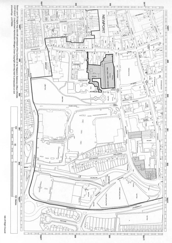
LOCATION AND SITE CHARACTERISTICS
The Bus Station is situated on the southern side of South Street and accessed via Orchard Street, in close proximity to the traffic junction of South Street, Church Litten/Town Lane. Application site includes not only the Bus Station and its adjoining buildings but also includes the vacant warehouse building and its curtilage which has a frontage onto Orchard Street and Bowling Green Lane. Also included is the three-storey building (3-5 St James Street) prominently located on the corner of South Street and St James Street providing retail accommodation on the ground floor with first and second floor office accommodation. This building is currently occupied by the Inland Revenue.
The Newport Library building is situated to the south-east of the Bus Station and is accessed off Orchard Street and via Church Litten. To the east of the Bus Station, accessed off Orchard Street, is a public car park providing approximately 32 spaces, and also accommodating toilet facilities along with an Information Centre.
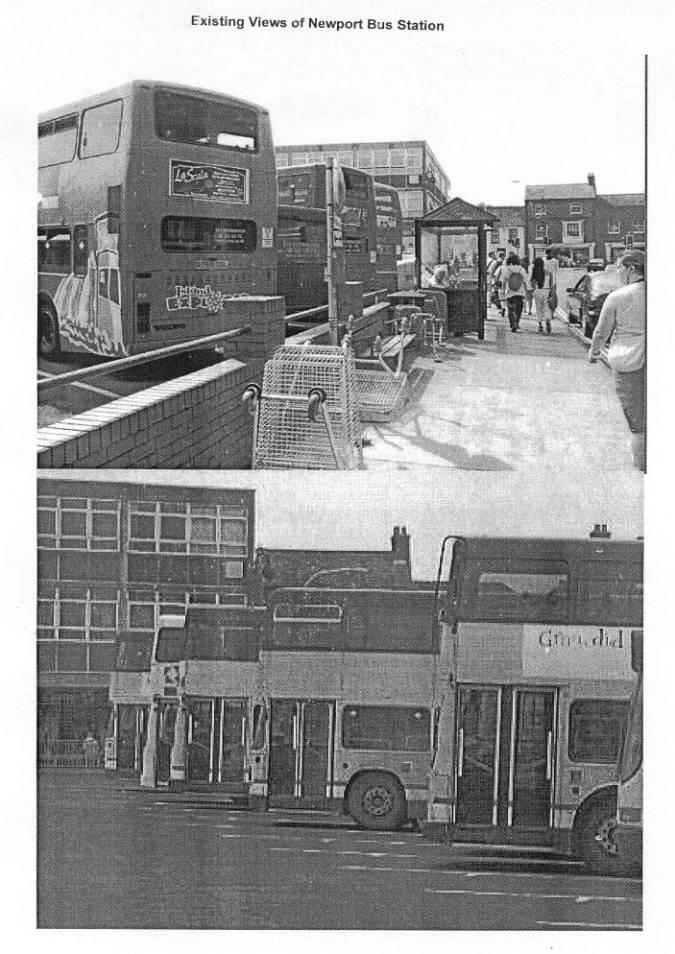
The main area of the site of the Bus Station dates back to the 1960s and not only provides bus stop facilities but layover facilities, with there being 13 existing layover bays and 11 bus stops, and consists of a concrete surfaced area with the buses entering via the Orchard Street junction with south Street and exiting at the western end onto South Street.
Recently there has been an introduction of a priority bus lane which runs in a west-east direction, with all other traffic travelling in an east-west direction.
RELEVANT HISTORY
None.
DETAILS OF APPLICATION
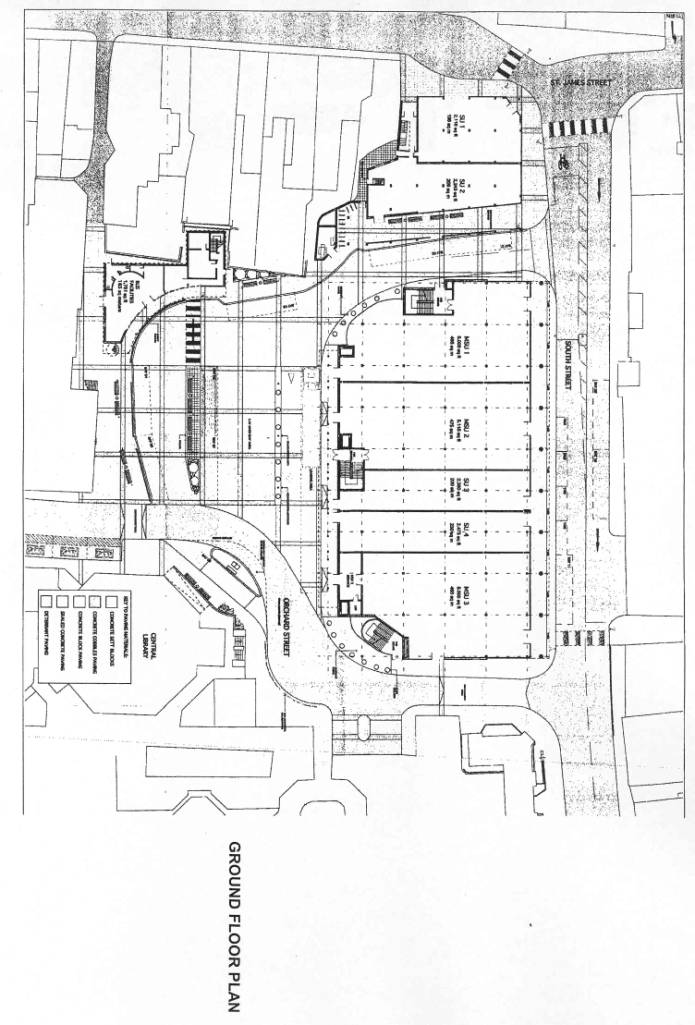
The proposal consists of four main elements and temporary measures to be undertaken during construction
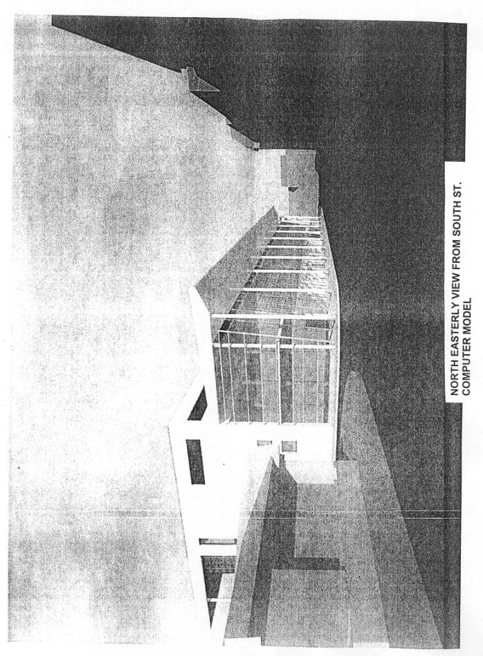
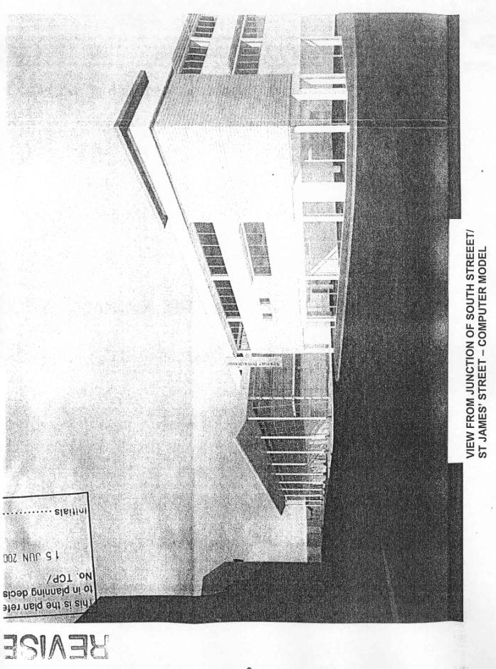
Retail Building
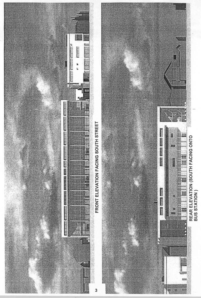
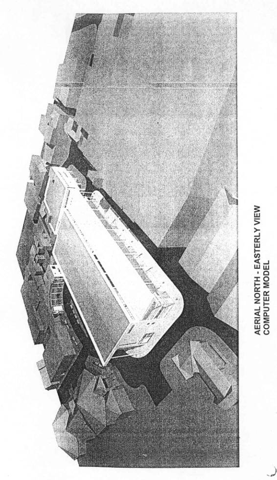
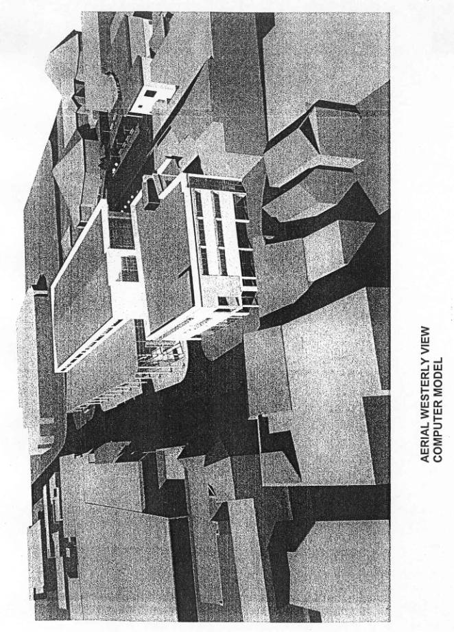
Main element relates to a substantial retail building measuring approximately 65.5 metres wide by 33.6 metres deep located on the frontage of the site, set back approximately 4 metres off the edge of carriageway, creating a wider footpath of that width. The block provides a total of 5,240 square metres floor space through three floors.
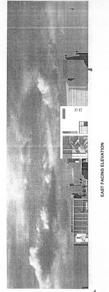
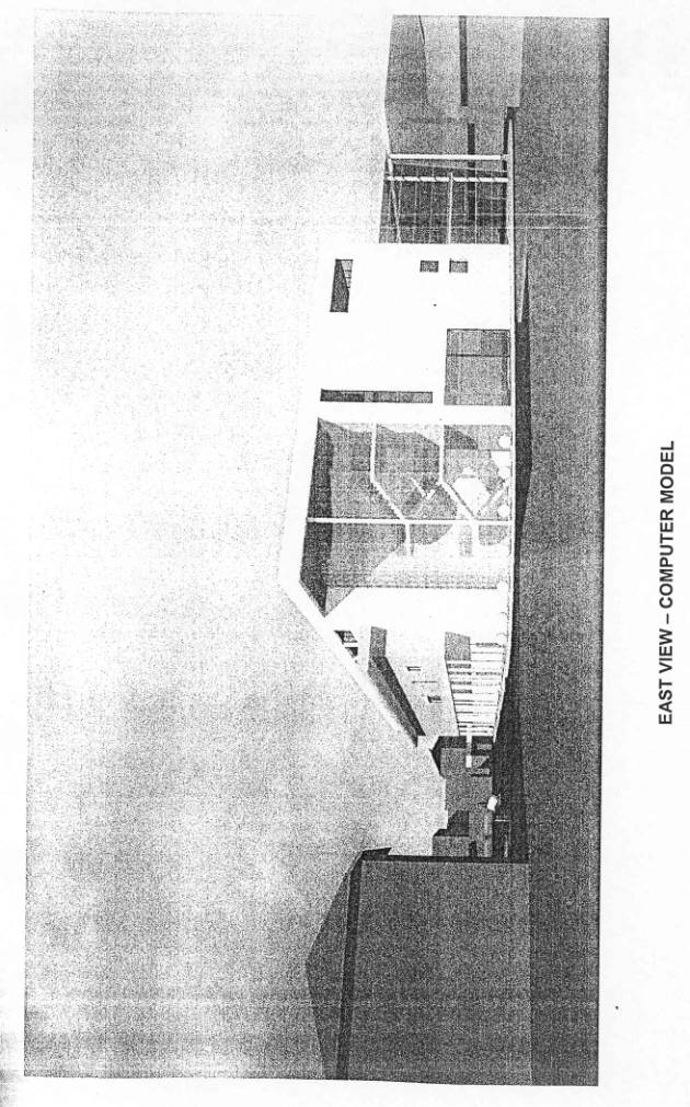
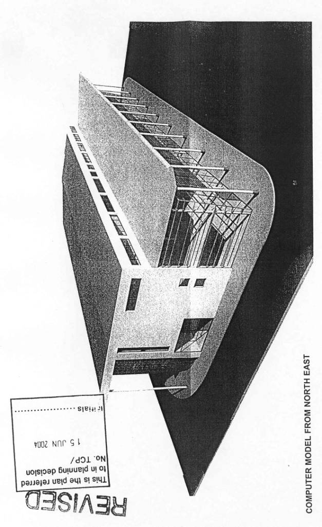
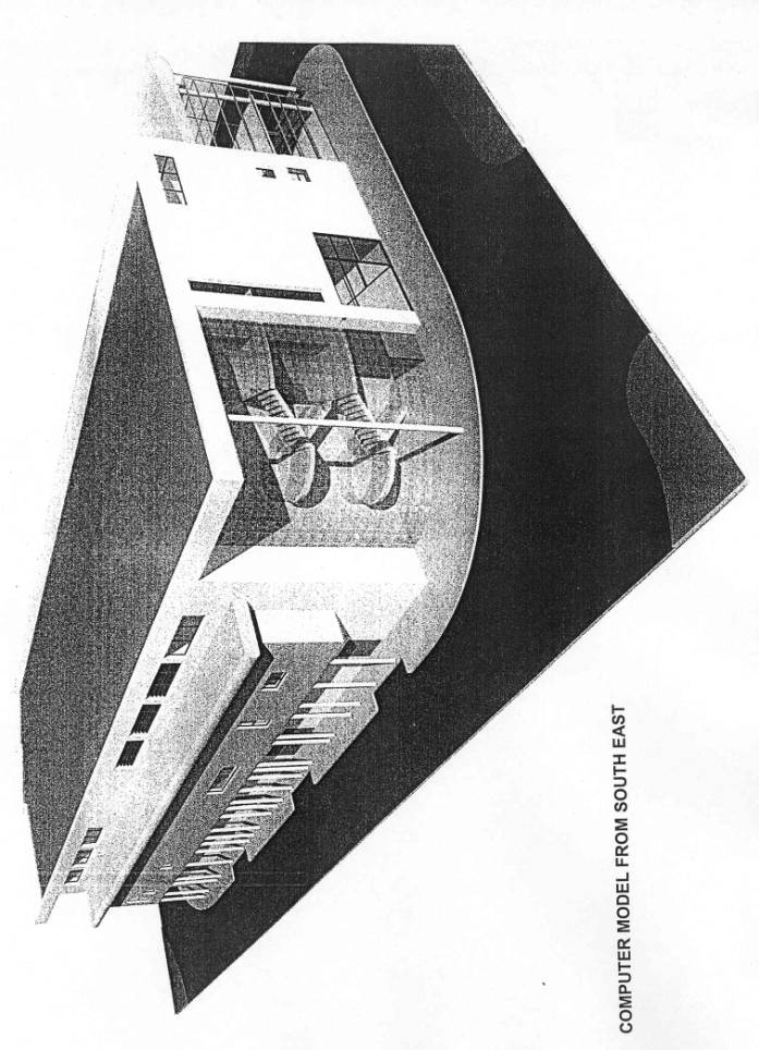
Building to be of a contemporary modern design reflected in the following use of materials.
· Use of flat metal cladding panels to upper storeys with architectural masonry at the ground floor level where impact damage could occur.
· Main South Street elevation consists of a combination of curtain wall glazing with large area of translucent cladding system with a step back at top floor level.
· South facing elevation differs in finish by use of acrylic self-coloured render panels with area of power coated louver system walling to lifts and vented areas.
· South Street elevation is articulated by using both vertical and angled treatments.
· Both the west and particularly the east facing elevation (onto the public car park) contain a mixture of the above-mentioned materials, with particular reference to use of curtain wall glazing on the corners nearest to South Street.
· Roof to be in the form of standing seam-coloured coated type steel system running from front to back uninterrupted and having a 3.2 metre overhang on the South Street frontage. South Street elevation also indicates a total of six full height tubular steel columns (three at either end), colour coated white. A further four single storey height columns centrally located are indicated, above which is the cantilevered vertical curtain walling. Columns will follow a line approximately 2.5 metres off the southern edge of the South Street carriageway, virtually along the middle of the widened footpath.
· All glazing frames to be in metallic silver finish.
In terms of uses, applicants indicate that the building will contain two levels of retail (ground and first floor), with a smaller element of retail-related office and storage/staff facilities on the second floor. The remaining area of the second floor could either be leisure or office, although the office use may be entirely on the basis that the present Inland Revenue use could be relocated from its existing premises.
The building has a maximum height of 14.2 metres at its frontage onto South Street which reduces to 12.8 metres on the south elevation.
3-5 St James Street – Refurbishment Proposals
Proposals provide for design remodelling and recladding works to this corner building by;
· use of timber cladding and self-coloured acrylic rendering;
· introduction of new glazing elements and translucent glazing panels;
· rear plant room/tank room to be reclad in louvred panels system;
· corner element of the building to be slightly increased in height, making use of a new parapet wall topped with a new flat roof and louvers.
Internal alteration will result in retaining retail use on the ground floor, creating two retail units of 196 square metres and 208 square metres.
The existing first and second floor office area to be converted into further retail sales space, each consisting of approximately 490 square metres each.
This may not be achievable if the Inland Revenue, the current occupiers of this space, desire to retain that occupancy. If this is the case, applicants state that the building would be subdivided into two, possibly three, individual smaller retail units.
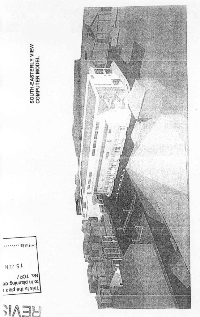
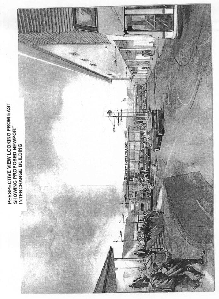
Bus Facilities Building
The new bus facilities building, which is two storeys in height and to be located towards the rear south western area of the site, with its southern elevation fronting onto Bowling Green Lane. This building to have a curved main elevation onto the Bus Station area and to provide improved bus facilities. Reference is made to driver and staff facilities on site, operational offices and control centre, and a public café facility and vending. Toilet facilities to be provided at first floor. The building to be flat roofed and to be constructed in similar materials to those already described in respect of the new retail block and refurbishment of Nos 3 and 5 St James Street. Proposal includes for flat roofed finish with extensive overhang supported by seven columns. Elevation which faces the Bus Station is heavily glazed and provision has been made for a circular external staircase providing separate access to first floor office, with that staircase being situated on the eastern side of the proposed building.
In total 330 square metres of space is provided, incorporating new passenger waiting facilities, information systems, driver facilities, covered cycle parking and safety and security measures.
Transport and Traffic Proposals including Traffic and
Pedestrian Movement
This is the final element of the proposal and relates to a new Bus Station, creating an interchange area for bus stops and bus layover facilities. The area will provide a total of seven bus stops, a layover bay area which provides sufficient space for at least six full size double decker buses, and a loading area directly abutting the southern side of the proposed retail building with sufficient space to allow at least two articulated lorries to park in tandem. The loading area has an overall width of approximately 7 metres.
Five of the seven bus stops will be around the southern and western edge of the perimeter footpath, with the remaining two being more centrally located alongside the layover bay area.
Vehicular access to this area will continue to be via Orchard Street both for buses and service vehicles, on an entry only basis. The alignment of Orchard Street remains unchanged, and that street will continue to provide access to the Pay & Display car park to the west of the application site.
Buses and delivery vehicles entering the interchange area will then only exit the site into South Street via a controlled junction. It is understood that priority will be given to exiting vehicles by way of induction loops within the road surface.
Cars exiting the Pay & Display car park will continue to egress left along the one-way system of Orchard Street to its junction with Upper St James Street. However, buses exiting the proposed bus stop directly adjacent to the Library will be able to pass through the interchange area to the access to South Street.
Offsite works in respect of South Street are as follows.
· Introduction of new traffic signals
· Removal of existing refuge island.
· Creation of new pedestrian refuge.
· Creation of two new bus stops within the recently created bus lane which has been reduced to one bus stop following discussions with the Highway Engineer.
· Retention of five taxi ranks on southern side of South Street.
The proposal provides for a priority pedestrian route between Church Litten/Library and South Street along Orchard Street via a 3 metre/3.5 metre wide footpath on eastern side of the new retail block.
A second pedestrian route in a westerly direction from the Library around the southern and western perimeter of the bus stop/layover area, with the pedestrians being controlled by way of railings. This pedestrian route to include a new pavement table across Orchard Street, creating a traffic calming feature. A second traffic calming feature indicated within Orchard Street close to its junction with South Street.
Surface treatments to be in the form of paviours, giving a grid appearance. Both the southern and western side of the proposed retail block to have limited block paved areas with elements of bollards, all to discourage general pedestrian access.
The application has been accompanied by a swept path analysis relating to a 12 metre long bus/coach accessing or passing through the interchange. It also includes swept path analysis relating to 15.5 metre and 16.5 metre articulated vehicles accessing and exiting the service bays. It is pointed out that the buses currently operated by Southern Vectis are generally 10 metre or less. Information is also provided regarding the numbers of bus movements within a typical weekday hour. They make the following comment regarding buses stopping in South Street as follows.
“Buses that stop on South Street will block the eastbound bus lane. The consequence is that, on occasion, buses in the bus lane will need to wait whilst the previous bus discharges or picks up. This is not unusual for an urban area of this nature, and Southern Vectis are satisfied that this is readily accommodated.”
Temporary Measures During Construction Works
Application details indicate that during construction works there will be disruption, and would be submitting a phasing plan of any such works. This is summarised as follows.
There may be a need for a temporary closure of Orchard Street in the vicinity of South Street.
During these periods of closure access to properties in Orchard Street can be maintained by implementing a two-way operation in the street.
Buses will not be able to use either the existing or the final facilities. Temporary facilities are therefore proposed which involves temporarily altering the priority on Church Litten and, following recent negotiation, these will be as follows.
· Church Litten becomes one-way, with two lanes northbound. The left-hand lane will be for buses only, the right-hand lane for general traffic.
· At its junction with South Street, the left-hand lane will be for general traffic, and this will only be allowed to turn left. The right-hand lane will be for right turning buses.
· Temporary traffic regulation orders will be required. These will be funded by the development.
· The traffic signals at the junction of South Street/Church Litten and Church Litten/M&S access will remain, but they may be modified accordingly to reflect the new priorities. The pedestrian crossings will remain.
· Southern Vectis will maintain an Inspector and Customer Information presence in the vicinity of these temporary stops.
Finally, the proposal indicates provision for an unsignalled pedestrian crossing at the northern end of Cockram’s Yard across Pyle Street linking to St Thomas’s Square.
Agents acting on behalf of the applicants’ architects
have also made a further detailed submission in terms of a letter of support
for the application and a retail impact statement. The letter addressed certain
matters which have been discussed at a meeting held in early April 2004 which
can be summarised in the following terms:
·
Retail impact assessment (see below).
·
The adjacent car park site owned by the Council.
·
Design/development brief.
·
Users of the bus station facility.
·
Section 106 contributions.
·
Processing and determination of the application.
The Retail Impact Statement concentrated on current
retail proposals; a planning policy overview; Newport town centre; a retail
impact analysis and conclusions. For obvious reasons the statement includes a
substantial amount of technical information and analysis and so for the
purposes of this report I am relying on a 13 point conclusion which includes
the following statement:
The proposal is fully in
accordance with local plan policy, which supports retail development on
unidentified sites within Newport town centre…
Similarly, the proposed
development is fully consistent with central Government advice PPG1, PPG6 and
PPG13 regarding location and sustainability of town centre and retail
developments.
The quality of assessments…
highlights the shortage of large space units in the town centre of 2000-10000
feet squared, which has resulted in the centre stagnating/under performing with
an increase leakage of consumer spend to Southampton. The bus station site is
the most appropriate location to accommodate the required retail development
and will provide an effective link between the High Street and one of the
towns’ principal retailers, Marks and Spencer.
Effectively, the bus station
development will act as a catalyst for further retail and other appropriate
development along South Street.
The site is the logical
location for new retail development in Newport and its’ redevelopment will not
preclude additional retail development coming forward in the future. The next
phase in likely to include the redevelopment of the adjacent car park site,
which will be able to accommodate additional quality retail floor space.
The overall conclusion is that this particular proposal
will have a positive impact on the town centre. In their view it will upgrade
the retail offer significantly, providing effective retail link and will
deliver the necessary investment to regenerate South Street, whilst acting as a
catalyst for further redevelopment in the future.
DEVELOPMENT PLAN/POLICY
Relevant objectives of this document are to provide guidance on the role of design considerations in planning, particularly in the light of the government’s quality in town initiative.
Under Annexe A of this document it advises that applicants should provide, as a minimum, short written statement setting out the design principles adopted as well as illustrative material in plan and elevation forms. This statement should show the wider context and not just the development site and its immediately adjacent buildings. Such material will be particularly important in relation to complex or large scale development proposals and those involving sensitive sites.
The main objectives are briefly summarised as follows:
PPS6 – Planning for Town Centres
This is essentially a consultation document which will eventually replace the PPG6. It is likely to be an important advisory document in the reassessment of retail policy during the Local Development Framework process and therefore it is appropriate to give it some weight at this time in assessing these applications. Brief summary of the document’s contents is as follows:
· Reaffirmation of the Government’s commitment to promoting town centre growth.
· Envisages planners taking a more pro-active role in town centre growth by promoting the bringing forward of a sites in a now “sustainable and inclusive” manner.
· The document envisages a less rigid hierarchy, with centres encouraged to develop their own specialisation.
In terms of development control, the document identifies a number of issues which should be taken into account, whether brought forward to implement up-to-date development plan allocations or on site other than those allocated on up-to-date plans. In this regard the document suggests that Planning Authorities should require applicants to demonstrate:
a) the need for development;
b) that the development is of an appropriate scale;
c) that there are no more central sites for development;
d) that there are no unacceptable impacts on existing centres; and
e) the locations are accessible.
Any development should satisfy all the above considerations, however exceptions can be made where overall weight of evidence justifies favourable treatment, even if the development performs poorly against one or more of these considerations. Where appropriate, local issues and other material considerations should be taken into account. Any information and analysis required should be proportionate to the scale and nature of the proposal in relation to the size and role of the centre. It emphasises the need to ensure scale of development is appropriate where it is taking place within existing centres.
Other issues covered are:
· Need for impact assessment.
· Choice of means of transport.
· Referral procedures.
· Area action plans.
· Improving access to town centres.
PPG13 – Transport
The aim of the guidance in this document is to:
· reduce growth in the length and number of motorised journeys;
· encourage alternative means of travel which have less environmental impact, and hence
· reduce reliance on the private car.
Relevant issues of importance are as follows.
· Consider impact of travel demand caused by development.
· Consider complementary transport measures.
· Revitalisation of existing central shopping centres.
· Provision for pedestrians should be high priority.
· Need for traffic management initiatives linked to the encouragement of improved public transport facilities with emphasis of provision of:
o Bus stations
o Bus priority measures
o Shelters
o Information centres.
· Develop strategies which avoid town cramming, ensure viability and improve public transport services.
Other detailed advice given relates to improving commercial practices in terms of:
· Delivery management
· Flexible working
· Alternative work travel plans
· Reducing dependency on cars
· Safety and security issues (use of CCTV)
· Cycle parking provision.
PPG15 – Planning in the Historic Environment
The document emphasises that “special attention should be paid to the exercise of planning functions with the desirability of preserving or enhancing the character or appearance of the conservation areas”.
The Secretary of State also considers that a material consideration in the planning of Authorities’ handling of development proposals should extend to those sites which are outside the conservation area but would affect its setting or views into our out of the area.
The document emphasises that the character and appearance of conservation areas should always be given full weight in planning decisions. The objective of preservation can be achieved either by development which makes a positive contribution to the area’s character or appearance, or by development which leave character and appearance unharmed.
As with other PPGs, it emphasises the need to prepare design briefs for individually important “opportunity sites”, with special regard being made to such matters as scale, height, form, massing, respect for the traditional pattern of frontages, vertical or horizontal emphasis, and detail of design. In general, standards should be applied sensitively in the interests of harmonising the new development with its neighbours in the conservation area.
Document also covers transport and traffic management issues as follows.
In developing projects which may affect existing centres, including historic towns, then full account should be taken of the wider costs of transport choices, including the impact on historic environments.
The Secretary of State attaches particular importance on traffic management and highway maintenance schemes and associated development proposals which would affect conservation areas. Planning Authorities are urged to seek advice of English Heritage where appropriate.
BY DESIGN – Urban design in the planning system: towards better
practice
This document, issued by the Department of Environment, Transport and Regions, represents a guide to promote high standards in urban design. It is intended as a companion to the PPGs and is written to stimulate thinking about urban design. It describes urban design as “the art of making places for people”, it emphasises the need to ensure “connections between people and places, movement and urban form, nature and the built fabric and the processes for ensuring successful villages, towns and cities”.
Local Plan Policies
Retailing
It is generally recognised that Newport is the main retailing centre for the Island with all but one of the allocated retail sites included within the Unitary Development Plan being in Newport.
In this respect land on either side of the existing Fire Station is one of the allocated sites which includes the ATS Tyres premises, a former public house and residential and commercial land/property.
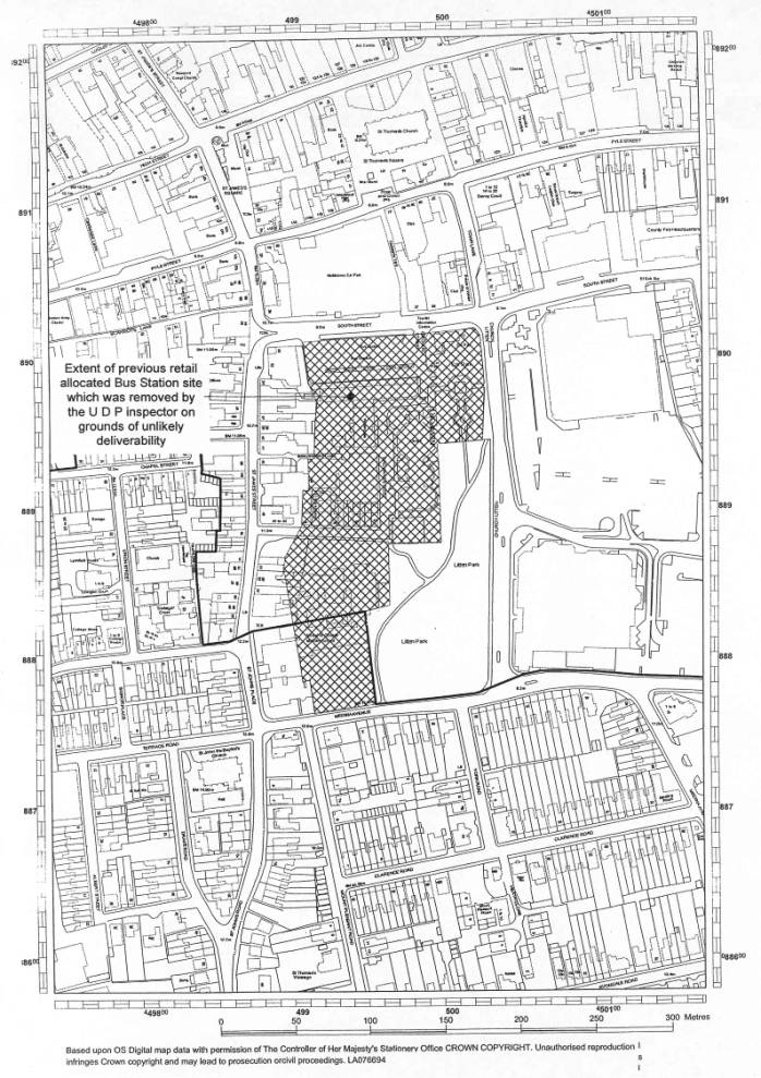
The Bus Station site, this was also put forward as a retail allocated site within the draft and consultation UDP proposals but was taken out by the Inspector on the grounds that deliverability was unlikely because of the overall size of the site. The Inspector’s reasoning has some considerable significance in respect of the current application, and is quoted as follows.
It is essential that a centrally
located Bus Station to serve Newport should be retained and indeed, if
possible, improved.
15.31
of the UDP does indicate that “a bus station facility could continue to be
retained within an overall scheme” but I do not regard this as being strong
enough. The Council accept that part of
Church Litten included in the site should be removed from it as it part of an
historic park and gardens of local interest.
The explanatory text already indicates that certain buildings on the
site, including the Library, would need to be replaced.
The
Council does accept that these various existing uses might well mean that a
comprehensive redevelopment will not be put forward. In view of the number of existing uses and constraints I would
anticipate this indeed to be most likely.
Although the Council states that “they would not wish to preclude a
comprehensive approach provided that the various elements could be
satisfactorily replaced or relocated” I do not regard this as being sufficient
reason to allocate the site for a “major retail development” when this is more
a vague hope than a serious anticipation.
I consider that the allocation should be removed from the UDP. The site should remain within the defined
boundary of the town centre so that if a potential developer were to produce a
comprehensive scheme, it would not be precluded from consideration under the
non site specific policies of the plan.
Other textual statements within the UDP are worth reference, as follows.
· The capacity analysis has identified scope for additional retail development, and a number of retailers are interested in establishing representation on the Island. There is scope for one additional food store of some 3,158 square metres (34,000 square feet) and 5,317 square metres (68,000 square feet) of town centre type retailing, or 9,011 square metres (97,000 square feet) of retail warehousing.
Textual analysis confirms greatest demand in Newport, and the fact that it would be “bucking the market” to try and deflect that demand to smaller centres.
Not surprisingly, policy statements relate to the advice in PPG6, and considers the number of sites put forward for Newport for which there would be demand over the planned period for both food and non-food shopping. Relevant retail policies are as follows:
· R1 – Existing town centres.
· R2 – New retail development.
· R3 – Sites for retail development.
· R4 – Developments on Unidentified Sites.
The above policy relates to the Bus Station site and is quoted as follows:
Planning proposals for retail development will be acceptable in principle when they are located within defined town centre shopping areas. Where no suitable town centre sites are available, to meet and identify the need sites on the edge of town centres may be considered where it can be clearly demonstrated that no other sites with better access to a town centre are available, or likely to become available; there is an overriding need for the scheme; the scheme does not have an unacceptable impact on the vitality and viability of existing centres, and the overall proposal accords with the Council’s overall strategy for sustainable development, in particular in respect of the use of means of transport other than the car. In addition proposals will only be permitted when they (a) will not result in the loss of identified employment land, (b) do not have an unacceptable detrimental impact on the historic character of the town, and (c) provide an appropriate parking and highway element which contributes to the effective management of the town in accordance with the Council’s overall strategy for sustainable development.
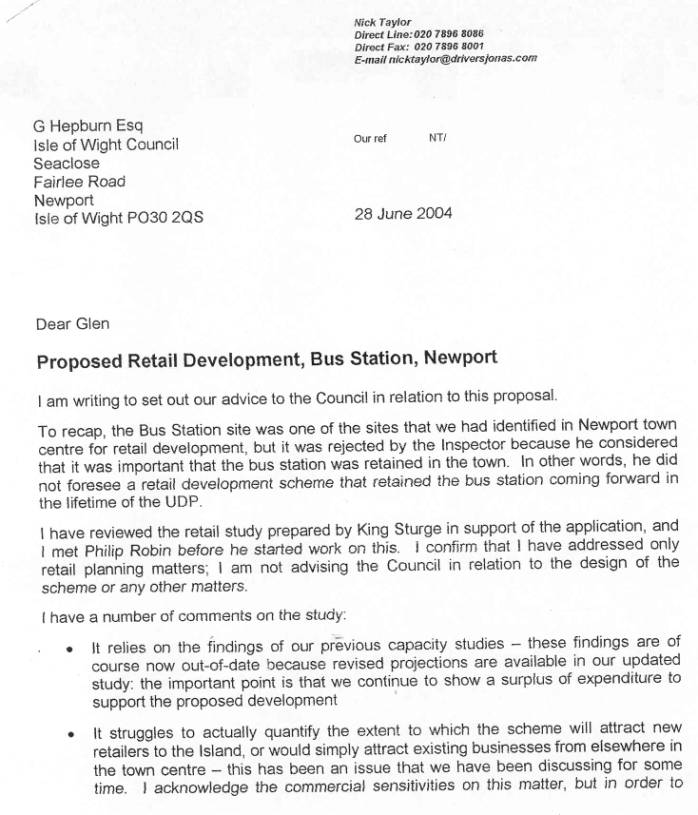
Drivers
Jonas, retail consultants on behalf of the Council, have set out their advice
and, as part of that advice, they have reviewed the study prepared by the
agents working on behalf of the applicants’ architects (see details of
application). Notwithstanding certain reservations about apparent shortcomings
of the aforementioned report our consultants, very importantly, make the
following key observations:
I
am not sure that two medium – large retail development schemes could be
supported in Newport and the same time, simply because the market could not
absorb two schemes at the same time. In my view, if consent is granted for this
scheme, I would not expect major retail development to come forward on the Fire
Station site. Indeed, on the latter site, I consider that it is relevant that
there are two applications for smaller scale development, which I believe
reflects the marginal retail potential of this location.
There
will be some change in the retail order within the town centre if this
proceeds. There will be a shift in the prime pitch towards the scheme, but this
is not necessarily harmful to the health of the town centre as a whole.
I
am satisfied that there is not an issue releasing a sequentially preferable
site before an allocated site. My reason for this is that the bus station site
had been identified for retail development, and the Inspector’s justification
for rejecting this scheme has been addressed i.e. the bus station is retained
with the scheme.
On a
point of information for Members the advice in respect of the two sites on
either side of the Fire Station accords with the officer advice given to the
applicants and agents at a recent meeting on how to progress those particular
proposals by ‘moving away’ from a retail orientated scheme(s).
Transport
Relevant policies as follows.
TR1 – An Integrated Transport Network
TR4 – Transport Statement Requirement for Major Development
TR6 – Cycling and Walking
TR7 – Highway Considerations for New Development
TR9 – To Encourage Provision of Improved Transport Facilities
Planning proposals for the development of modern public transport facilities, including the upgrading of existing or development of new boat, bus or rail interchanges, will be acceptable in principle where they meet the following criteria:
(a) they involve the upgrading and/or the creation of facilities for pedestrians, cyclists and those people with mobility problems;
(b) they allow for easy transfer between different modes of transport;
(c) they would not prejudice the future improvement to, or upgrading of the transport interchange;
(d) the scheme will not have an undue environmental impact.
Proposals which would result in the loss of transport interchange facilities must ensure that improved alternative provision is provided elsewhere prior to the development taking place.
TR16 – Parking Policies Guidelines
The site is within Zone 2 of the parking guidelines policy, and therefore falls under the auspices of the Transport Infrastructure Payments requirement which requires, as a material consideration, the seeking of the legal agreement with the applicant by which a contribution will be made to finance off-street transport initiatives to help address the travel demands generated by the proposal. The policy is part of a strategic approach, with such contributions being held in a sustainable transport fund, money from which will be used for the provision of facilities or measures to assist public transport, walking or cycling, the need for which is reasonably related to the proposal. Financial implications relate to payments of £275 for each 10 square metres gross floor area, new or additional, being achieved, and relates to commercial developments of 100 sq metres and over.
General
Location of Development
G4 - General Locational Criteria of Development a, b, c, e, h and k.
Design and Standards for Development
D1 - Standards of Design
Relevant caveats are as follows:
a) Respect the visual integrity of the site and the distinctiveness of the surrounding area.
b) Sympathetic in scale, materials, form, siting, layout and detailing.
c) Of a height, mass and density which is compatible with the surrounding buildings and uses.
d) Provide for safe, convenient access and circulation for the public, including the disabled.
f) Respect historic street and footpath patterns.
g) Do not constitute overdevelopment leading to cramped appearance and obtrusiveness, but include appropriate spacing between properties.
j) Retain, maintain, enhance and/or create open spaces, views or other features which significantly contribute to the area.
D2 - Standards for Development within the Site
Relevant caveats are as follows:
a) Achieving a high standard of design and relating well to adjacent buildings.
b) Taking account of views into and out of the site.
D5 - Shop Fronts and Signs
D10 - Street Furniture
D11 - Crime and Design
D12 - Access for People with Disabilities to Buildings Open to the Public
D14 - Light Spillage
Utility and Community
Services
U11 - Infrastructure and Services Provision
Relevant Strategic Policies are as follows.
S1, S3, S5, S6, S11 and S15.
Implications
The content of the above policies will indicate to Members the complexity of the primary considerations which will need to be addressed in the determination of this application. Judgements will need to be made as to the level of weight that should be given to various policies (both national and local).
The decision by the Inspector on the Unitary Development Plan to remove the site of the bus station from the retail allocation, whilst still retaining the fire station site in a retail location, does present a difficulty but given that the bus station site in locational terms is likely to be the preferred option in terms of viability because of the juxtaposition with the prevailing retail pattern in the town centre and other associated facilities this is an issue which should not be given significant weight. If Members consider that the bus station scheme as submitted is acceptable then the likelihood of the allocated Fire Station site being developed for solely or predominantly retail purposes in the shorter even medium terms will clearly be reduced. Retail consultants retained by the Council advise that the bus station site is more deliverable than the Fire Station/South Street site, be more able to accommodate a large modern retail unit.
It is anticipated that the Local Development Framework procedure will provide an opportunity to consider future retail strategies for Newport which can be best informed by the production of an appropriate study document to provide the guidance to all the interested parties. The problem is that, in the absence of such a study, can the Planning Authority reasonably withhold a decision on these applications in terms of their proposed retail uses. In this regard, members’ attention is drawn to the initial comments of our Consultants who, recognising that the Fire Station site is somewhat remote from the “prime retail frontages”, accepts that it is unlikely to be attractive to unit shop retailers. They comment significantly, however, as follows.
…. There
is certainly an issue that, if it were allowed to be developed out entirely for
non retail uses, it does leave a lack of sites for the next generation of
retail development which would ultimately put pressures on you to release other
edge of centre sites such as Riverside Way.
Whilst some may argue that there is the option of refusing the Bus Station application on the grounds that it is premature in the absence of the new Local Development Framework it is my firm view that such a decision would be unreasonable and would not be sustainable on appeal.
Members will appreciate that land assembly is the only method by which larger sites can be created, and in this regard the Council have a role to play, particularly with regard to land in their ownership which, when linked to other land, can create valuable development opportunities and thus play a proactive role in planning retail development in Newport. Whilst Newport does not have any competing towns on the Island it continually competes with nearby mainland shopping centres, particularly Southampton and Portsmouth. Therefore members may consider that despite the lack of supportive background advice these proposals, particularly the Bus Station, presents an opportunity to recapture some leakage
CONSULTEE RESPONSES
Highway Engineer recommends approval but comments as follows:
· Majority of original concerns have been addressed.
· Compromise solution has been achieved omitting one of the two proposed bus stops which were proposed on the bus lane.
· Reduction to one bus stop will reduce impact on store deliveries to Somerfield’s, however this has only been achieved by
o providing a footway width of 3.5 metres on the north side
o reducing the width of the southern footpath by 0.5 metres
o providing a “build out” adjacent the northern footway.
· Essential to retain a minimum 5 taxi bays.
· Essential that projecting canopy provides protection for pedestrians waiting for taxis.
· If possible a further reduction in the width of the southern footway would mitigate problems on northern footway.
· Important that a detail safety audit is provided.
· It may be possible to allow one bus stop in St James Square but only if other arrangements were accommodated which are likely to involve costly engineering works.
Highway Engineer requires a number of technical traffic controls to be covered either by condition or more likely by legal agreement.
The application has been considered in some detail by the Architects’ Panel. Packages of information including the design statement and extracts of plans were circulated to Panel members prior to them attending the meeting. The Panel were not supportive of the proposal and a full text of their comments is attached as an appendix. The following, however, is the agreed summary of the Panel:
“In conclusion members were of the opinion that the development was motivated by maximising the size of the proposed building and the site value at the expense of the public facilities. This scheme was not considered to be pedestrian friendly and needed better links to the town. Reservations were expressed regarding the servicing of the buildings and also about security issues relating to the Bus Station. The Panel agreed with the aims and values outlined in the Design Brief but did not consider that these had been achieved by the development as submitted.”
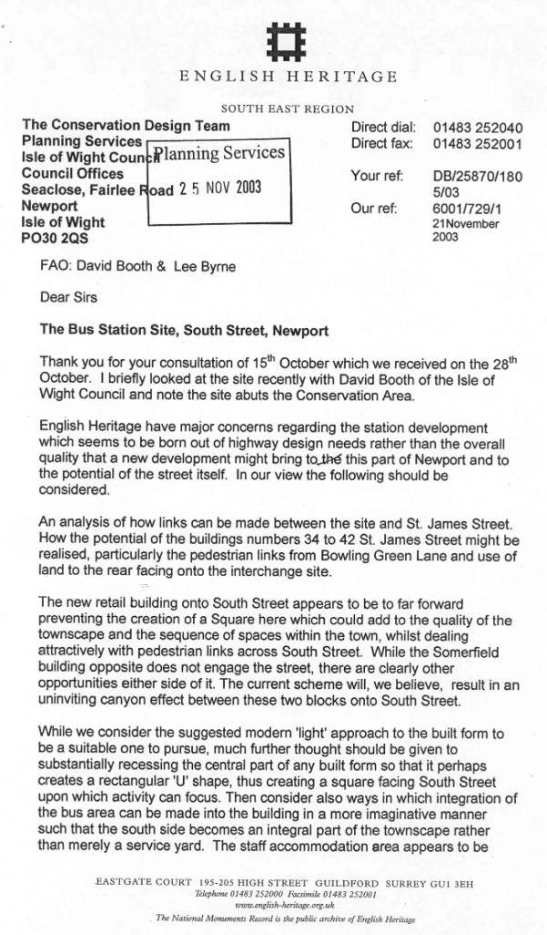
In view of the location of the site in part within the Newport Conservation Area, with the main retail block being outside but adjacent to the designated area. The comments of English Heritage were sought. These are summarised as follows.
· Concern the scheme born out of highway design needs rather than overall quality.
· Greater attention should be given to links between the site and St James Street, and whether or not properties which front Upper St James Street, with reference to 34-42, might be incorporated into the scheme. Particular reference made to the inclusion of Bowling Green Lane and the use of land to rear facing into the interchange site.
· Position of the retail buildings prevents any creation of the square abutting South Street which could add quality to the townscape and sequence of spaces within the town, whilst dealing with pedestrian links across South Street. Accepted that Somerfield building does not engage the street, however other opportunities exist either side. Concern that current scheme may result in an uninviting canyon effect between the two blocks.
· Consider modern approach to be suitable, although further thought should be given to recessing the central part, creating a rectangular U-shape, resulting in a square facing South Street which could attract activity.
· Consider ways of integrating the bus area into the building in a more imaginative manner, with reference to the south side becoming an integral part of the townscape rather than a service yard.
· Reference made to design statement giving an impression of engagement of the frontage activities but suggestion that the scheme itself does not achieve these aims.
· Overall it is considered that a more holistic approach is necessary for the particular regard to linkages north across South Street towards Pyle Street, and how development can relate to proposals being considered between Pyle Street and South Street.
· Suggestion that there is sufficient substance within the scheme for the Planning Authority to consult CABE (Commission for Architecture in the Built Environment).
Council’s Retail Consultants gave an initial overview as follows:
· They support the principle of the Bus Station as an appropriate retail development site. They accept that it does not link into the prime retail area, as would be immediately apparent, however it does offer an opportunity to provide a large modern unit attracting good quality new retailers.
· They consider that the Bus Station is considerably more deliverable than the Fire Station/South Street site.
· They acknowledge that design issues are involved, and that the highway matters are complex.
· They list a number of specific questions which need to be answered as follows:
· Is this an appropriate location for retail development?
· Will the scheme link well with the existing retail offer?
· Are there changes to the scheme which will enhance the linkage?
· Will the scheme take retailers from the existing prime, and will this have a negative effect?
· Is there a better location for a retail scheme?
· Will the Bus Station site development thwart the delivery of an alternative scheme which would be better for Newport, either now or in the medium term?
· What impact would the scheme have on the potential of the Fire Station site?
Consultants make reference to the potential for further development on the public car park/toilet site corner of South Street and Church Litten (consultants confirm that the developers were aware of, and would be interested in, this site, however from a planning point of view Planning Authority would need to consider whether an extended scheme would be better or worse for the town).
Crime Prevention/Architectural Liaison Officer has been consulted, with the whole scheme being discussed with him by the applicants. His comments are as follows.
Applicants have discussed the proposal with the Architectural Liaison Officer, who generally supports the scheme on the basis of use of CCTV cameras which will continue to be linked to the cameras of the Isle of Wight CCTV control room as part of the Newport scheme.
He confirms the general layout has taken crime and disorder issues into consideration, and acknowledges that an area behind the waiting and vending area which could have caused problems will now be gated.
Crime & Prevention Officer consider the existing FIZ building creates blind spots and could this not be an opportunity to remove that building?
He suggests that application could be subject to Section 106 Agreement requiring further funding from the developers to overcome one or two dark spots between the road and the Children’s Library. Ideally the removal of the FIZ building, new landscaping and extra lighting would change the area completely, reducing current problems.
He recommends bus stops are of the “see-through” type and shelters should be considered that are graffiti and damage protected by sheets of security film.
Other issues as follows.
· No need for ram-raided bollard as records indicate that this is unlikely to be required.
· He acknowledged that, where appropriate, deterrent pavement and bollards have been included.
· He acknowledged that the lighting scheme would be of great importance, with the area needing to be well lit, although precautions need to be taken to reduce light pollution to a minimum.
In general the Architectural Liaison Officer has no objections to the proposal, although he would need to be consulted with regard to contents of 106 agreements.
The Contaminated Land Officer recommends appropriate conditions should the application be approved.
The Archaeological Officer recommends appropriate conditions.
Comments of Council’s Building Control Engineer on applicants’ environmental desk study are as follows.
“This report comprehensively investigates environmental issues based on a desktop study and some on-site investigations, to establish design criteria for foundations and whether further investigations are necessary on any other environmental issues such as archaeology, unexploded bombs from World War II and contamination from leakage of oils, fuel, oil tank and previous laundry development.”
One of the critical outcomes of a meeting with the
applicants and their agents about three months ago was some difference of
opinion in terms of the overall merits of the scheme in a design context. It
was agreed that one way of progressing this particular issue would be the
involvement of CABE who could offer a professional assessment of the overall
design of the scheme. For Members information CABE (Commission for Architecture
and the Built Environment) are a government funded organisation which offers
independent expert design advice on the quality of important schemes which are
likely to have a significant architectural impact.
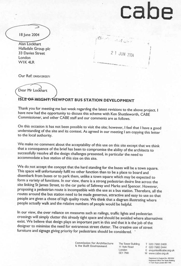
The applicants and their agents met with a design
review adviser for CABE. He subsequently wrote to the applicants on 18 June
2004 and made a number of points which can be summarised in the following
terms:
·
A consequence of the brief has been to compromise
the ability of the architects to successfully resolve all the design challenges
presented, in particular the need to accommodate a bus station of this size on
this site.
·
In his view all the routes around the bus station
need to be made generous, attractive and easy to use so that the people are
given a choice of a high quality route.
·
In their view the over reliance on measures such as
railings, traffic lights and pedestrian crossings will simply clutter this
already tight space and should be avoided where alternatives exist. He
advocates the create use of street furniture and signage giving priority for
pedestrians.
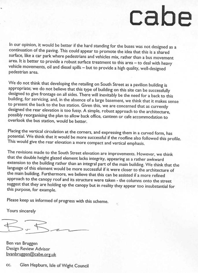
·
In terms of the proposed building, specifically the
rear elevation (i.e. facing the new reduced bus station area) he recommends, “
a simple, robust approach to the architecture, possibly reorganising the plan
to allow back office, canteen or café accommodation to overlook the bus
station”.
·
He also offers advice on principle design elements
in terms of the overall appearance of the whole building particularly when
viewed from locations noted for high pedestrian movement.
THIRD PARTY REPRESENTATIONS
Isle of Wight Bus Users group make the following statement.
“We wish to write in support of the application, and this is the view of the majority of our committee and those members attending our recent meeting.”
They also state that “there are some details which we wish to comment on which were the subject for discussions between the committee and the bus operator”. A summary of the points are as follows:
Design does not satisfy aims contained in Design Statement by the applicants, with particular regard to the need for pedestrians to cross roadways in order to reach bus stands or the shops.
The mixture of the bus station and the goods delivery area for the development within such a large area of pavement not conducive to good security, particularly if no officials are on duty.
Concern that provision of seats will encourage a congregation of vandals, which could lead to anti-social behaviour. Reference is made to a number of examples of bus stations on the mainland which have become unpleasant places to wait for buses.
The large paved area could encourage skate boarding unless appropriate materials are used.
Users consider introduction of waiting room is welcome, however have extreme concerns regarding the introduction of vending machines, unless those machines are supervised by staff.
Group would seek assurances that very bright lighting is used to deter anti-social behaviour.
The bus stops are in many instances further from the shops than presently exist.
Group suggests that queues should be arranged to face oncoming buses.
Inspectors should be on duty throughout the whole traffic day.
Further suggestions are made as follows:
Information should be visually prominent, and there should be clear, audible announcements.
Concern that the disabled and elderly traveller are adequately catered for by the introduction of (a) guidance strips for blind people, (b) warning strips, (c) symbols for use by illiterate, (d) clear markings of steps, stairs, edges etc.
Three letters of objection received, one from Ventnor resident, one from Ryde resident and one from Islandwatch. Points raised are summarised as follows.
Proposal will have adverse impact on the retail attractiveness of other Island towns.
Despite use of CCTV, proposals will result in anti-social behaviour.
Rather than seek retail development in Newport, other Island towns should be considered for retail investment.
Other points made by Islandwatch as follows.
Proposal facilities are cramped and are not as user friendly as the existing facilities.
The positioning of the bus stop outside the library will create an appearance that traffic along Orchard Street will be passing through the bus station thus presenting a hazard to passengers.
They are not convinced that Newport needs more retail outlets, making reference to empty premises in the town. Planning process should be protecting Island’s communities rather than helping big retailers cut their costs. Design of the retail building is abysmal, with only high quality design being acceptable.
Cladding on the office building on the west of the site is inadequate, with the view that the building should be demolished.
EVALUATION
The application has been accompanied by detail evidence by various competent professionals who have supported the applicants' stated objectives to create the following:
Members should be aware that discussions have taken place with the applicants which have only resulted in minor adjustments to the scheme, with the basic application remaining as originally submitted.
An overview analysis of the general planning policy implications of this proposal on the overall Newport/Island retail strategy has already been covered. The following issues need to be considered.
The scheme itself is restricted virtually entirely to land which formed part of the original Bus Station plus the warehouse premises and therefore could certainly not be deemed to be a comprehensive development for the whole area. A plan has been received showing the development of the adjoining car park site.
This would seem to suggest that the current submitted scheme was considered mainly in isolation in respect of the land to the south, including the Library and the commercial building south of Bowling Green Lane. The original retail allocation (in the draft UDP) covered an extensive area and included the Library, commercial building south of Bowling Green Lane, the Council's car park and the small rose garden area of Church Litten. It was the unlikelihood of assembling all these elements that influenced the UDP Inspector to remove the retail allocation. Significantly however, he removed the allocation with the knowledge that the site was within the defined boundary of the town centre and therefore if a potential developer were to produce a comprehensive scheme it would not preclude it from consideration.
A more comprehensive approach will be the preferred option, and in this regard, had there been a planning brief for the area, then this would have assisted any individual developers in formulating schemes for their own sites which could have embraced the overall planning strategy for the area. In the absence of such guidance the applicants have taken a more individualistic approach with any adjoining development proposals, with particular reference to the car park site having to fit with the current proposal rather than approaching the overall development with all such developments functioning together, both visually and environmentally.
The combination of these facilities may be better achieved by spreading the development over a wider area which would potentially overcome the design and transport issues which are clearly causing concern. In essence, the greater the site area the greater the flexibility.
I return to the UDP Inspector's comment, within which he makes reference to the production of a comprehensive scheme which could be considered despite the fact that the site has not been specifically allocated for retail development (my emphasis).
Following on from the above, the Planning Authority will need to establish whether the overall size of the application site is sufficient to make it suitable for the level of development being proposed I refer to the revised plans. This is fairly fundamental, the UDP Inspector considered that it was essential that Newport has a centrally located bus station, and even made reference to the possibility of improving those facilities. This current proposal provides both of those aims, but it may be more efficient to locate the bus station on an edge of town site as opposed to a centre of town site.
Other considerations may be the level of facilities provided in terms of accommodating buses. A bus station could be simply limited to dropping off and picking up passengers on a short stay period basis only, with it being in the form of a series of bus stops either in lay-by or echelon form not dissimilar to the type of bus facilities provided on Ryde Esplanade.
The current application seeks to retain the status quo while refining the operation by making it more user friendly. Proposal does however continue to cater for some layover for buses when not in service, although emphasising that the main depot in Nelson Road will be more intensively used as a layover for buses when not in service.
Applicants consider therefore that by using the available land more efficiently the operation of the bus station will be more streamlined and therefore more able to be accommodated within the overall size of the site. Members may consider, however, that the fact that bus stop is required on the newly formed bus lane would suggest that the size of the site is not able to accommodate all the operational uses required by the bus operator, and that this may be an indicator that the size of the site is unable to accommodate both a substantial retail building and an efficient user friendly bus operation. The tightness of the site is further emphasised by the introduction of wall to wall retail floor space at both ground and first floor level, with the main anchor retail unit at first floor and including some ancillary retail space at second floor.
A comparison of the proposed overall floor space with other stores in Newport suggests that the current proposal provides approximately twice the floor area of BHS store and is very similar to the Marks & Spencer store which is on a single floor.
The original overall design concept has been the one which has received most criticism, with both the Architects Panel and English Heritage raising similar fundamental observations which would need a total change of approach to enable those concerns to be addressed. The general theme of the comments suggests that the basic proposal represents an over-development of the site and links to the comments raised above. There is a general view that the essential operational needs of the level of development being proposed have not been successfully integrated into the overall design concept, with the result that the proposal does not do justice to this very important site. The fundamental common issues raised by both the Panel and English Heritage relate to:
Applicants' architects have not surprisingly put together what effectively is a rebuttal to these concerns. In summary, the most important points are as follows:
Design to be flexible, to appeal to new businesses, therefore plan form reflects simplicity of design in a location in a street scene which has very limited inherent character.
Deliverability of all the design intentions has proved difficult, making reference to the various interested parties that influence the outcome.
Pedestrian movements very much reflect operational requirements of the bus company, but consider that the proposed arrangements represents considerable improvement on the existing situation. General interchange area is designed to be pedestrian friendly, with control of pedestrian routes only being necessary where there may be conflict with vehicular movements.
Maximum use of site on the South Street frontage between ingress and egress points is intentional in the interests of the street scene and significantly reflect the likely future development of the car park site. Street vehicular entrances made deliberately narrow to deter pedestrians from using the inward side of the streets.
Introduction of additional fenestration on the more bland elevations likely to be at odds with retailer requirements. Glazing concentrated on the side elevations to the feature corners to achieve maximum visual prominence, with the remaining element of the side elevation and south facing elevation being articulated by way of use of a variety of materials. Architects state that more glazing may be introduced if tenants so desire.
In terms of criticism in respect of space for delivery, architects point out that there are generous loading zones for the units which will enable waiting and passing to take place.
Architects emphasise that this is a building that should be seen in the "round" with no elevation being any less important than the other, with particular reference to the comparison to the elevation on South Street. The servicing elevation is to be disguised by way of a colonnade and strict controls will be applied in terms of no external storage or refuse.
Of particular importance is the role played by the interchange area, which meets the requirement of the bus operator. Architects point out that "far from being hidden away behind the new building, the new interchange area will be altogether more open to view but nonetheless physically containable, being surrounded by other buildings offering a new setting and visibility for the main library entrance".
It is the architects' intention that the interchange should have a visual character of a public square, making reference to use of appropriate material, street furniture, lighting and even tree planning. Whilst this area will not function as a public open space it should have the appearance of one. Use of surface treatments will emphasise pedestrian routes, enhancing desire lines, making reference to those desire lines which exist from South Street to round the library entrance, across the rose garden to Safeway/Marks & Spencer shops and parking.
In terms of the criticism regarding the lack of open public space on the South Street frontage, architects consider that such a need for public open space in that location would be unnecessary given the close proximity of Church Litten. They also point out that the introduction of such an open space would reduce lettable area and the desirability of the units to retailers.
Use of hard paved material changes will clearly separate public vehicle movement from the interchange traffic area. They point out the manoeuvring areas for buses have been fully tracked and agreed.
Emphasis placed on the level of facilities being provided by the interchange building. They also emphasise that covered bus stands are provided and the whole area will be fully covered by CCTV. Finally they refer to the support of the Council's Crime Prevention Officer in respect to the proposals.
In terms of the failure to include the car park site architects state the following:
The concept of bringing together the SVBC ownership site and the car park and public toilet site as a comprehensive development is not deliverable at this time. The present scheme is designed, however, to allow extension or abutment to any such scheme on the corner site and, as such, issues of additional servicing and pedestrian flows are already addressed.
Applicants' architects express disappointment at the Panel's comments, and continue to stand by the scheme as submitted as being deliverable and sustainable for the centre of Newport.
In terms of English Heritage's comments, a letter has been sent by the architects to English Heritage which makes, in general, similar references to those described above, and significantly do not offer fundamental changes to the scheme.
I am in receipt of a general comment from the Council's Conservation Team following the Architects Panel and English Heritage's comments and the exchange of correspondence with the architects, and in summary they comment as follows:
Overall I am concerned that the submitted details and the subsequent negotiations have resulted in individual concerns being discussed and, to some extent, addressed without resolving the fundamental issues and resolving the overall conflicts within the site. In particular, the use of the site for retail purposes while retaining the bus station facility has put considerable pressure on the overall layout and detailing of the various uses. While some of the concerns regarding access routes, etc have been addressed, these have merely resulted in channelling of pedestrians by the introduction of barriers, surfaces and other highway clutter without improving the quality of the urban development. The aims of the development as identified in the initially submitted design statement appear to be sound, but have not been addressed in the submitted details. Further discussions and revised details have attempted to overcome some of these issues, but have not fundamentally addressed the concerns expressed by the Architects Panel and other consultees, and do not address the wider issues of the use and urban form of this part of Newport.
At this point I would quote from BY DESIGN as follows:
“Development can help define streets and public spaces – Streets, squares, parks and other spaces can be defined by appropriately scaled buildings and trees. The height of buildings should relate to the width and importance of the space (including streets) which they enclose. The massing and height of a building should also have regard to the degree to which it will overlook and overshadow other buildings.”
Members will appreciate from the extensive level of design advice input and general rebuttal of those adverse comments, the issue of overall design, which not only includes the architectural appearance of buildings but the overall holistic design approach, has proved to be probably the most critical and most difficult to assess. The subjectivity of assessing the suitability of architectural appearance is well known, however to have two sources of design advice, i.e. Architects Panel and English Heritage, coming up with similar critical statements, makes it difficult to justify why those comments should be set to one side. However, on the basis that this is the only scheme that has come forward as an application, Members may consider greater weight should be given to the economic argument that Newport needs this development and should grasp this opportunity.
This is a basic difference of opinion, with the applicants claiming, not unsurprisingly, that they have successfully achieved a development within the constrains of the site boundaries and which caters for the bus operator's needs and future retailers' needs whilst still having sufficient design quality and architectural appearance to enhance the area visually. This is contrary to the views of the Architects Panel and English Heritage, who essentially consider that the constraints being placed upon the design process are simply too much and the scheme as submitted, however well defended, is not of a standard compatible with the importance of the site and fails to achieve the laudable aims contained with the design statements.
A small step to progress has been made in that we have consulted with CABE who are interested in providing detailed design comments on the overall scheme. The architects met CABE and tabled a different plan which was not part of the planning application but showed the top floor of the proposal set back with a view to reducing the canyon effect. It was a pity that this plan appeared to be in response to the architects meeting CABE and was not submitted to use until recently.
CABE looked at this plan closely and raised several concerns which can be seen in the attached letter. It is my interpretation of this letter that they were quite critical in that the bus areas appear too tight and did not allow for the comfortable use of this area of space. The town square approach was dismissed and attention was given to the building. It was suggested that the staircase areas should be made more of a feature and the canopy of the roof reduced. There as also a weakness in the design on the front canopy which did not appear robust and having any integrity to the main building. These comments with suggested ways of improving the scheme have been submitted to the applicant for him to take on board so a more agreeable solution can be made. This request was sent out during the preparation of this report.
Members will note that Highway Engineers are recommending conditional approval, however this has followed extensive negotiations with the applicants’ traffic and transport consultants, and the length of time this has taken reflects the complexity of the various issues. Indeed, these Highway Engineer recommendations were only received on 5 March 2004. Members will also note that the applicants are now indicating only one single bus stop on the north side of South Street served off the bus lane. Even to achieve this the applicants have had to widen the footpath and provide a build-out area on the north side of South Street and reduce the footpath width on the south side outside the proposed retail building from 4 metres to 3.5 metres.
The agreement with the Council’s Highway Engineers to achieve one bus stop reduces further the width of the footpath which serves the frontage of the proposed retail store. Again this indicates that the proposal is too tight.
The Highway Engineer states that: “although this plan requires some minor amendments insofar as it is essential to retain at least 5 taxi bays, it is otherwise tolerable.” He even suggests that, subject to the detailed layout, the southern footway may be able to be reduced further without causing a problem, and would in fact mitigate the problems on the northern footway.
Traffic issues are of vital importance in respect of this town centre site and therefore members may consider a more confident supportive statement would have been preferable. The use of the word “tolerable” does suggest an almost reluctant acceptance of the traffic designs, and even this acceptance has reduced the already minimal footpath width in front of the retail store on the South Street frontage. Ease of movement is an important issue alluded to in the BY DESIGN guideline, and I quote from this document as follows:
“Transport routes should reflect urban design qualities and not just traffic considerations – streets should be designed as public spaces, not just in response to engineering considerations.”
Finally, whilst acknowledging the reduction in number of bus stops on the northern side of South Street, the one bus stop that is being proposed does not indicate provision of a bus shelter, presumably because there is insufficient space to accommodate such a shelter.
The above apart, however, certain planning observations could be made with particular reference to general environmental impacts that are likely to be caused of a result of the juxtaposition of the bus interchange area set to the south of the retail unit.
Firstly, It is accepted that essentially the level of bus movements within the interchange area will be similar, if not slightly less, than currently occurs. The number of bus stops within the interchange area is reduced, although this is at the expense of a requirement for bus stops within the recently formed bus lane. The change in terms of traffic movement is that the area is also to serve as a service vehicle area, which is likely to involve not only small service vehicles but also potentially articulated lorries. While space has been set aside, not surprisingly the applicants have given no numbers of vehicles that may be involved, for this will be dependent upon occupiers of the retail development and, more significantly, the method by which they manage delivery vehicles, with particular reference to timing and regularity.
The second issue regarding this matter is the sheer visual prominence, and therefore impact, that this level of vehicular movement may have when linked to the regular comings and goings of buses. Obviously the issue of sufficient space for tracking etc of the vehicles is technical, and whilst the applicants’ highway consultants have been able to satisfy the Council’s own Highway Engineers on this issue, the general visual environmental impact will need to be considered as well.
Similarly, with regard to tracking and the capability of road systems to accept the additional service vehicle traffic both entering and leaving the site, there is the matter of environmental impact that this level of traffic may have on users of those roads, both pedestrian and motorists. Yhe number of vehicles involved will grow according to the amount of retail floor space becoming operational. Linked to this would be additional traffic implications that may emerge should adjoining land be further developed, particularly at the same density of retail space as being proposed by this application. From all this Members will appreciate the pressures that would be brought to bear on road systems which are already straining to cater for existing flows without adding to the level of increase that could result from both the proposed development such as this application and other developments that may take place.
Again I refer to the operational use of the Bus Station, with particular reference to the layover area. Members may consider that this is an opportunity to take this aspect of the use of the Bus Station out of the new scheme. Apart from the potential difficulties of managing a layover area where buses will be parked in tandem and could, if not managed properly, involve considerable amount of manoeuvring, there is the visual impact of buses parked in a group. This could present a solid mass of buses as opposed to the current layover facilities which are at least in a row with each individual bus being capable of being manoeuvred separately without the need to move other buses.
Finally on this issue in terms of visual impact would be the introduction of a bus stop in the bus lane. Again, if the Council’s Highway Engineers could be convinced that this is acceptable, in pure highway technical terms I would pose the question that there is unlikely to be sufficient room to provide a bus shelter. In any event, the issue of what visual impact a bus shelter may have would need to be a material consideration and would be yet more street furniture to integrate into the overall appearance of the area. It would be unfortunate that those users waiting for buses at the bus stop on the bus lane could not have the facility of a bus shelter, both in the interests of their own comfort and also crime prevention. This does not appear to be an issue which has been addressed by the applicants, with the reason for the bus stop being that there is insufficient room within the new bus interchange area to accommodate all the required bus stops.
In planning terms it is recognised that there will be a need to separate the pedestrian from the bus/service vehicle movement, however inevitably this will mean the introduction of railings etc, and this, coupled with all the other street furniture, etc could result, unless it is carefully handled, in an overall cluttered appearance which would be to the detriment of the overall scheme. I am confident that the architects are aware of this danger and would obviously choose the hard landscaping and street furniture schedule very carefully.
Generally it is important that members appreciate that whilst I am certain the bus and service interchange area will be carefully considered, particularly in respect of quality of hard landscaping, it is a working area containing a regular flow of vehicles, both static and moving. This is the price that has to be paid for retaining the site as a bus terminal/station, and as long as Members wish this to continue in this location, and as long as the Highway Engineers are satisfied with the technical issues of vehicular tracking etc, I can do no more than point out the visual implications of this continued use.
Finally, proposal does provide for some offsite highway improvements which involve the creation of a pedestrian crossing at the northern end of Cockram’s Yard to assist in encouraging pedestrian flows in that direction, and improvements to the eastern end of Bowling Green Lane. With regard to the latter issue, Members will be aware that Bowling Green Lane is hardly the most inviting of public pedestrian thoroughfares, and it would be hoped that this development would provide an opportunity to extend the upgrading of Bowling Green Lane through to its junction with Upper St James Street. If Members are mindful to approve the application, it may be worth seeking agreement with the developers to achieve this added benefit.
Members will note that the Council’s Architectural Liaison Officer (Crime Prevention) is generally supportive of the scheme, although he does express concerns regarding certain blind spots. Reference in this case is made to the FIZ building and the suggestion that its removal would help open up the regular pedestrian route from Marks & Spencer’s and Safeway’s through Church Litten, and make it a safer route generally. This building contributes little to the area generally. It was required to have been demolished following the construction of the library. It is appreciated that it is a useful building and provides useful floor space, presumably relatively cheaply, it does represent a constraint on good quality development of the area given its relatively prominent position.
Other comments made by the Crime & Disorder Officer are noted and would either be covered by condition or through the auspices of a legal agreement if approval is granted.
Generally the application is for retail use although there is a suggestion that part of the second floor could either be used for office use, particularly if the Inland Revenue decided to relocate, or there has been an inference that leisure use could be introduced. Obviously the latter use would be likely to result in the building being operational through the late evening hours which, according to advice within National Policy documents, is important as it contributes both to the evening economy and therefore the viability and vitality of the town. Also continuous use of the building assists in panning out crime and general control of anti-social behaviour. If the use of the building relates only to retail and possibly office, then it will make little contribution to the evening economy.
Due to the extensive construction works the issue of disturbance and temporary measures has been addressed, with particular reference to temporary bus service facilities along Church Litten. Again the Highway Engineers are generally supportive of these proposals. There is likely to be the need for a temporary portakabin type building to control the bus services. Obviously this proposal will involve major development works which may involve a number of years before completion. In terms of the bus interchange, however, applicants have indicated a programme consisting of four phases to be carried out within an approximate period of 12 months. A level of disturbance and road closures are involved, however this is inevitable for contracts of this size, but applicants have clearly recognised this fact and have been discussing these matters with our Highway Engineers.
The proposal indicates the retention of the taxi rank bays in South Street, which is important that these provide an essential alternative transport facility. However, their location in front of the main elevation of the retail store will result in a visual impact. Members will be aware of an existing shelter for those waiting for buses on the southern side of South Street, however this application does not indicate the retention of that shelter.
The second issue relates to the implementation of the transport infrastructure payment policy. Because of the extensive nature of retail and potential office space being proposed, and the site’s location with Parking Zone 2, this proposal will attract a level of payment of £162,250. This is purely based on the new retail space being provided within the new retail building, and does not include the retail/office space being indicated in respect of Nos 3/5 Upper St James Street. Members will be aware that this financial contribution goes into a sustainable transport fund which will be used for the provision of facilities or measures to assist public transport, walking or cycling, the need for which is reasonably related to the proposal. This figure would be reduced to approximately £121,000 when existing floor space is deducted.
When applying the policies in this case it is recognised that the proposal does obviously involve the retention and upgrading of the existing bus station facilities, however the proposed retail floor space will have an impact on transport infrastructure by the mere fact that it will, if successful, attract more people into Newport.
This element of the proposal has received little or no criticism apart from the observation that it represents a missed opportunity in terms of demolishing this poor quality building and replacing it with new build which would do justice to a very prominent corner position. It is important to appreciate that this element of the proposal is within the Newport Conservation Area and therefore very much the subject of a need to ensure preservation or enhancement.
The above apart however, Members
have no option but to consider the application as proposed, and in this case
the decision is to carry out cosmetic external alterations to the building in
the form described, and as such can do nothing but ensure preservation of the
building, which has little or no architectural merit in any event and
certainly, providing the detailing is acceptable, will represent an enhancement
of that building. Both English Heritage
and the Architects’ Panel consider the principle of this approach to be broadly
acceptable, although the Panel did consider more could be made of the corner
features. They also considered some
projecting features would improve appearance and reduce horizontal emphasis.
It is my view that it would be
extremely difficult to promote a fundamental objection to the redevelopment of
this site for retail/public transportation purposes. Indeed when examining the
overall strategic aims of the Council it is apparent that the promotion of such
a significant investment in the town centre which will not only provide new
purpose designed retail units improving the shopping experience for residents
and visitors alike but also retain a public transport destination which is
ideally located in respect of the existing town centre, Safeways/Marks and
Spencers and other associated facilities. Consequently in terms of principle
the application is supported.
However, issues relating to the layout, design and the scale, mass and design of the proposed principle building have consistently caused concern to not only professional officers but also English Heritage, the local Architects Panel and CABE.
With some justification the applicants and their agents are concerned at the length of time that it has taken to process and determine this application. More recently, there has been significant progress on a number of issues but there remains the outstanding matter of design with the relatively recent reservations and suggestions made by CABE to be taken on board with other concern expressed about the applicants architects approach to the project from both inside and outside the Council.
In balancing the aspirations and frustration of the
applicants and the genuine concerns about achieving a successful development on
this important and prominent site it was decided that the matter should be
reported to the Development Control Committee in order to establish Members
support for the principle of redeveloping the site with all the associated
detailed issues raised and assessed in this comprehensive report and to share
with officers and consultees/advisers their concern that in design terms the
scheme could be further improved in order to achieve a development that
significantly enhances the area and hopefully precipitates further major
investment in immediate locality particularly along South Street and into East
Street down towards Coppins Bridge. It is my view this is a reasonable
approach.
Throughout this process consideration has been given to the rights set out on Article 8 (Right to Privacy) and Article 1 of the First Protocol (Right to Peaceful Enjoyment of Possessions) of the European Convention on Human Rights. The report makes a recommendation to defer a decision on this application pending improvements to certain elements. The legitimate aim of the Council’s Unitary Development Plan and the public interest will be considered when the application returns for formal approval and/or refusal.
Notwithstanding the need to take advice from outside of the Authority
on matters relating to the retail impact and design of the overall scheme it is
clear that the processing of the application has become unduly protracted and,
in my view, the best way of moving the matter forward is to obtain agreement
and support from this Committee for the principle of the redevelopment together
with all the various detailed
aspects which would allow all parties to focus on the single remaining issue
which is the design approach.
In my opinion the advantages of agreeing this particular suggested
resolution is that the applicants and their agents can progress the matter
quickly with the benefit of the knowledge that the principle for the
redevelopment of the site in terms of the ‘mix’ (i.e. retail and continued use
a public transport interchange) and the associated detailing is supported by
this Committee whilst senior officers will have the benefit of a reassurance
from Members that the approach adopted in handling this particular case is
supported but before granting (conditional) permission they will need to be
satisfied that the design issues have been satisfactorily resolved.
RECOMMENDATION
–
APPENDICES
Contact
Points: D C Manager (Chris Hougham) Tel:
823576
Major Submissions
Leader (Glen Hepburn) Tel: 823575
Principal Planning
Officer (John Fletcher) Tel: 823598
ANDREW
ASHCROFT
Head of
Planning Services